GeoCarta Has Moved

Jan 31, 2006

Shreveport Elementary School Training The Cartographers Of Tomorrow

Instead of just listening to a lecture on their unit on maps and measurements, kindergartners and first-graders at Arthur Circle Elementary have been actually taking measurements and making maps.

The Shreveport Times observed a group involved in mapping the school grounds:
They carefully lined up their rulers on the ground between two oak trees until they determined the distance was about 32 yards. Then, they shrieked and cheered.

Seven-year-old Molly Washington explained the excitement: "We get to learn about stuff while we do it."
The activity is funded through a grant from the Alliance for Education. The kids have already made maps showing playground equipment, trees and buildings on and off campus. Next, they will use software purchased with the grant money to add directions on how to get from one location to another to their maps.

No need to worry that a bunch of school-aged map-makers will flood the job market though. Molly told the Times that it will be awhile before the kids use their new cartographic skills for real: "probably when we're grown-ups" she said.

MapBiz: Online Mapping Business Put On The Market

So you've tried Google Earth, Yahoo Maps, and Microsoft Live Local and figured you could do better? Now may be your chance to jump into the booming internet mapping business. LandNet Corp. announced today that it plans to sell its LandVoyage Internet mapping business.

Not surprisingly, the parent company has a number of reasons why their site is better than the rest. They say that they have three main advantages over their online competition: Map content variety, functionality, and geographic search capabilities.

A purchase will get you the LandVoyage database of seven digital map layers and five satellite/aerial imagery data sets in an array of resolutions and scales. Any purchaser also gets a proprietary suite of software that includes an Internet/intranet map server, advanced geospatial search engine, and an e-commerce solution. The deal will also include 49 recently awarded patent claims, and 92 patents that are pending.

So all you would-be internet mapping moguls, get out your checkbook and contact investment banking firm Sarowdin Partners of Denver, about making a deal.

Jan 30, 2006

Gulf Coast Navigation Charts Posted Online

Almost five months since Hurricanes Katrina and Rita struck the Gulf Coast, ports on the gulf and channels on the Mississippi River are still finding obstructions in the water and new areas of shoaling that pose a danger to shipping.

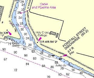
To help speed the recovery effort, the National Oceanic and Atmospheric Administration's (NOAA) Office of Coast Survey has launched the Coast Pilot Disaster Impact web site. The web site features maps of currents conditions at 21 port facilities along the Gulf Coast impacted by Hurricanes Katrina and Rita. The maps include information on: pilotage, channel, side and approach depths, anchorages locations, obstruction hazards, bridge information, storage and supply facility information, overhead or surface bottom cabling, small craft facilities, status of wreck removals, and wharf information.

The site also has a link to allow port facility managers to send information on underwater obstructions and other hazards directly to the Office of Coast Survey. The Office of Coast Survey will then post the information on the web to alert other ships.

The navigation charts can be found here.

Corrections & Clarifications

Time for some housekeeping:

Google Earth Popularity Booms: #8 In U.K.
This post should have stated about Google Earth, "... the site ranking as the eighth most searched for website in the United Kingdom." Thanks to an anonymous commenter for the clarification.

NOAA To Put Historical Maps & Instruments On Display
One of the agencies whose maps and instruments will be on display is the U.S. Coast and Geodetic Survey. I erroneously abbreviated this agency as "USGS," when it should have been abbreviated, "USC&GS." The USC&GS is now known as the National Geodetic Survey, which is part of the National Oceanic and Atmospheric Administration. Thanks to retired member of NOAA for pointing out the mistake.

If Maps Are Free Who Will Pay The Mapmakers?

With the increasing popularity of free, web-based mapping services, National Geographic Maps, faced a tough situation. How do you stay in the map business when your competitors are giving away their product?

The Denver Business Journal explains how the Colorado-based company is restructuring to adapt to the changing business climate. The Journal explains that the company realized it could only survive in areas outside the consumer mainstream. So National Geographic Maps is retreating from publishing maps for the general public and is focusing instead on detailed maps targeted for outdoor recreation enthusiasts, emergency responders, geologists and other field workers who often venture out of well-traveled terrain.

The firm, which is a taxable subsidiary of the nonprofit National Geographic Society, now sells about 70% percent its maps through retail outlets such sporting goods stores. It is collaborating with ESRI, on several mapping initiatives aimed at its niche market and is also focusing on updating and digitizing its product to print maps on demand through its Web site.

President Fran Marshall told the Journal that National Geographic Maps is doing "quite well" financially.

Jan 29, 2006

Hurricanes Alter Gulf Landscape, Perhaps Forever

Evidence of last years record breaking hurricane season can still be found as one gazes upon the landscape of the Gulf Coast. "Nothing's been like this," Abby Sallenger, a U.S. Geological Survey oceanographer, told the Associcated Press, during a recent flight over the northern Gulf Coast to study shoreline changes.

Rethinking A Coastal Map?

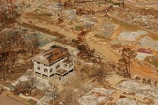
Between 2004 and 2005, "we've basically demolished our coastline from Galveston (Texas) to Panama City, Fla. It's getting to the point that we might have to rethink what our coastal map looks like." Barry Keim, the state climatologists in Louisiana told the AP. All along the coast, researchers have found the landscapes changed by hurricanes Katrina, Rita and Dennis. Some barrier islands are almost gone, while on others, beaches are scattered like bags of dropped flour. It is estimated that Hurricanes Katrina and Rita destroyed more than 100 square miles of wetlands in Louisiana alone.

Permanent Change?
Of course hurricanes were active in the Gulf of Mexico long before Europeans discovered it. But most researchers agree that the shoreline has remained relatively the same since the 17th century. But with some climatologists saying that we are entering a period of frequent and intense hurricane activity, things may change for good. "It may bring about a situation (in which) the change is so rapid, it's something that's very different from what the ecosystem experienced over the last three, four thousand years," Kam-biu Liu, a Louisiana State University professor and hurricane paleoscientist told the AP. "We may be losing part of our beaches, we may lose our coastal wetlands, and our coastal forests may change permanently to a different kind of ecosystem."

Model For The Future?
Whatever shape The Gulf of Mexico takes in the future, scientists agree it's becoming a perfect place for oceanographers, marine biologists, geologists and geographers to study. Steven F. DiMarco, an ocean researcher from Texas A&M University said, "I think," he said, "people are looking to the Gulf of Mexico ever more as a microcosm of the world."

The Frustrations Of Being Left Off The Digital Map

As online mapping sites have become more popular, life has become more frustrating for those not shown on the digital maps. The Rock Hill Herald reports today on the frustrations of people living in newly developed areas whose addresses have yet to make it into cyberspace.

Among the annoyances:
  • David Beatson of Lake Wylie, Virginia spent weeks trying to get a newspaper delivered. The paper couldn't figure out which route his address was on.
  • A couple of people mentioned having to constantly give directions to friends that are used to looking up directions online.
  • PeeDee Kurfess of Fort Mill, Virginia encountered another problem after moving into her new home. Whenever she tries to change her address on web-based forms, it can't be done because the new address couldn't be verified electronically.
The article gives an overview of the process the online mapping sites go through to update their maps. Jeremy Kreitler, product manager for Yahoo Maps, told the Herald that people who want their address included can contact Tele Atlas and NAVTEQ directly through their web sites and request that they update their information.

Despite the inconvenience of trying to get his newspaper delivered, Mr. Beatson says that there are advantages to being off the world's digital map. "In today's world, you don't have too much anonymity," he told the Herald. "Sometimes I like having someone not being able to get to my house."

Antique Maps On Display In Miami

"Cuba and the Caribbean in Old Map," selected maps from the collection of Claude Alix has opened at the Deering Estate in Miami, Florida. The Miami Herald reports that the collection highlights rare maps of Cuba, Havana, Hispanola, Martinique and Guadalupe from the 16th-20th centuries.

More than 30 historic charts, maps and documents are on display. Among the highlights are; a 1592 map of Cuba by Abraham Ortelius; Giovanni Antonio Rizzi-Zannchi's 1787 map of the Gulf of Mexico; and a rare map by Andrew Bell of Havana in 1762.

The map exhibit is located in Richmond Cottage and will run through March 26. Admission to the map exhibit is free. It costs $7 to get into the park itself.

Jan 28, 2006

NOAA To Put Historical Maps & Instruments On Display

“"Treasures of NOAA'’s Ark," an exhibit featuring technologies developed by the National Oceanic and Atmospheric Administration (NOAA) will be displayed at the agency's headquarters in Silver Spring, Maryland next month. The exhibit will feature early scientific instruments, maps and charts from the U.S. Weather Bureau, U.S. Bureau of Fisheries, and the U.S. Coast and Geodetic Survey (USC&GS). Founded in 1807 by President Thomas Jefferson, the USC&GS is the country's oldest government scientific agency. NOAA will have experts on hand to explain the history and uses of the displayed items as well.

NOAA Chief of Staff Scott Rayder said, "“Visitors to Treasures of NOAA’s Ark will get a glimpse into the fascinating history of technologies and services we all take for granted today, from Global Positioning Systems to weather satellite imagery." The exhibit will be in the NOAA Science Center at 1301 East-West Highway in Silver Spring and runs during the second annual NOAA Heritage Week, February 6-11, 2006.

Corrected 01/30/06

Jan 27, 2006

MapBiz: Intergraph Says Restructuring Not Finished

One day after issuing its earnings report for 2005, Intergraph filed Form 8-K with the Securities and Exchange Commission. In the form, the company said that its plan for streamlining its operations will not be finished until the second quarter of 2006. The firm also said its restructuring costs will be $19 to $21 million, not the $16.3 - $18.3 million it previously estimated.

If there is one thing that makes Wall Street nervous, it's companies that try to sneak out bad news right after trumpeting good news. Intergraph's stock price fell almost 2% today.

Judge Ordrers Removal Of Playground On Land Mapped For Parking

Terri Protos of Fairview Beach, Virginia, thought she was doing a good deed when she went door to door to raise money for playground equipment. She eventually raised $5,000 to purchase and install three swings and a slide in her neighborhood. But after reviewing a 70-year old map, Judge J. Peyton Farmer ordered her to remove the playground equipment, ruling that it lies on land dedicated for parking.

As reported by the Free Lance-Star, Norman and Mary Lee Goodridge, who live in front of the playground, filed the suit. They argued that allowing the playground would set a precedent, that would allow others to use the property however they wanted.

Supporters of the playground testified that the land had never been used for parking, as shown on the old map. But the judge's order held that the land could only be used for the purpose designated on the plat. In addition to ordering the removal of the equipment, Judge Farmer ordered Ms. Protos to pay $500 in legal fees to the Goodridges.

It's quite common to see areas on old maps with designations such as, "Square," "Green," "Open Space" or "Park." The case should caution anyone to carefully investigate such property before using it.

MapBiz: Intergraph Reports Improved Performance

Intergraph Corporation announced financial results for 2005 that showed improving performance at the spatial information management company. While revenue for the 4th quarter of 2005 was down slightly from the previous year, operating income for the quarter showed an improvement from $9.8 million to $10.4 million.

For all of 2005, Intergraph reported revenue was $577.6 million, an increase of 4.8% from 2004. Operating income for 2005 was $32.5 million. While that was down slightly from 2004, the figure included restructuring charges of $11.7 million for the year, operating income before the restructuring charges was actually up.

Halsey Wise, President & CEO was quoted as being pleased with the company's performance saying the numbers, "... illustrate the substantial progress Intergraph has made in improving operating performance." Apparently Wall Street agrees, the firm's stock price has risen almost 80% since last March.

Lost & Found: Tracking Loved Ones With GPS

Cell phone provider Verizon Wireless plans to launch a Global Positioning System (GPS) child tracking service in its cell phone in May of this year. According to Mobile Tracker:
The service will debut on the LG Migo, a kid-friendly phone that the carrier launched late last year. Privacy concerns have stalled the launch of a GPS based tracking service so far, but Verizon Wireless has apparently decided that it will be a popular feature for safety-conscience parents.
The service will reportedly cost between $10 and $15 per month. Parents will be able to locate the Migo phone within several yards using the their own cell phone or an Internet site. Parents can also receive a text message if the child leaves a designated area in a service called "“geo-fencing."”

While Americans have struggled with privacy issues inherentnt in the technology, in Japan they seemed to have embraced such services. Asahi.com reportsts that such GPS tracking services are a popular way of keeping track of senior citizens.

Families are increasing asking elderly members who suffer from such things as Dementia and Alzheimers to wear a tracking device. In Nara Prefecture, six municipal governments have been offering GPS devices to residents since 2004. Family members that fear a loved one has wandered off can simply call up the fire department which will fax them the elderly member's current position.


Street Map Stirs Controversy

A new street map of Northern Ireland's second largest city has stirred a long simmering controversy over what the city's name should be the Belfast Telegraph reports. The new map, the first of the city in ten years, will become available next Monday. What's unusual about this map is that the name on the cover and the title used inside will be different.

The cover of the map will state that it is a map of, "Derry". However, Ordinance Survey Northern Ireland has stated that inside the map will use the name, "Londonderry" until a legal challenge to have the name officially confirmed as Derry have been settled.

The confusing situation is part of a long effort to have the City of Londonderry officially re-named Derry. Nationalists on the city council want the city to be called, "Derry" which derives from the city's ancient Celtic name of Doire, or Daire. The name was changed to Londonderry back in 1613, and the unionists want to keep it.

As if having two names for one city isn't confusing enough, there has been another trend develop in the area. Back in 2004, when the city council was first preparing to mount its legal challenge to have the name of the city officially recognized as Derry, officers wrote to all the various bodies with "Londonderry" in their titles asking them to change their names to "Derry." Some agreed to the change, some declined to change, others, however decided to avoid the issue altogether and replaced the name Londonderry with the inoffensive title of Foyle.

Jan 26, 2006

Mississippi Town Adopts New FEMA Flood Maps

Aldermen in Ocean Springs, Mississippi have passed a new city flood plain ordinance The Mississippi Press reported. The law requires new homes and businesses in the city to be built one foot above the recent advisory flood elevations issued by the Federal Emergency Management Agency (FEMA).

In November, FEMA issued new flood plain maps for three coastal counties in Mississippi in response to Hurricane Katrina. The new maps, which are currently only advisory, have substantially higher flood elevations than the existing maps. Even though the new maps are not official yet, FEMA urged local government to use the new maps to regulate rebuilding efforts. However, many communities have been reluctant to adopt them, saying that such action would increase the expense or rebuilding too much.

City Community Development and Planning Director Donovan Scruggs told the aldermen that Ocean Springs' new ordinance puts the city in compliance with the new FEMA flood insurance regulations and could reduce residents flood insurance premiums up to 10%.

Eventually, all communities will have to adopt the new flood maps are be dropped from the National Flood Insurance Program. The new law only enforces the higher elevations on new construction. Buildings damaged by Katrina can be repaired and remain their existing elevation.

Jan 25, 2006

Commerce Dept. Announces Plans For GPS Upgrade

Addressing the U.S. Chamber Media Forum today, Deputy Commerce Secretary David A. Sampson announced plans for a major upgrade of the United State's Global Positioning System (GPS) service.

The highlights of his speech were:

L2C Signal
Deputy Secretary Sampson officially announced a new signal, L2C. This signal is broadcast on the latest generation satellite that was declared operational in December. The L2C signal, was specifically designed with commercial needs in mind. It is more reliable and more powerful to allow receivers to work better in urban areas and indoors. It also requires less energy to receive the signal, which is an important feature for devices such as cellphones. L2C is broadcast at the same radio frequency already used by many users for high precision work, such as land surveyors.

A Third Signal
It was also announced that the United States plans to add a third civilian GPS signal. This signal will be designed to meet the needs of airlines and other "safety-of-life" transportation, and will include an exclusive radio band, higher power, and greater bandwidth. The government also plans to integrate it into the national transportation system.

A Fourth Signal
Deputy Secretary Sampson also said that the U.S. has begun work on a fourth signal. Plans call for the fourth signal to augment the original L1 signal. The U.S. plans to work with Europe, Japan, Russia, and other countries to make this signal an open, international standard.

A Commitment To The Future
The deputy secretary stated that the Bush Administration is committed to providing GPS to the world. That the U.S. intends to continue policies designed to promote commercial uses of GPS, and to constantly upgrade the system.

Perhaps mindful of the coming competition among satellite navigation systems, he concluded by saying of the government's plans, "... this will keep American technology at the center of innovation and will fuel the engine of global economic growth and opportunity."

Deputy Secretary Sampson's complete speech can be read here.

U.S. Announces GPS Upgrades

As previously announced, Deputy Commerce Secretary David Sampson announced new Global Positioning System (GPS) capabilities today. The secretary said the improvements will lead to greater accuracy and reliability, and will benefit cell phone communications.

RCR News has the story:
"The new signal-known as 'L2C-was specifically designed with commercial needs in mind," said Deputy Commerce Secretary David Sampson in remarks prepared for delivery at a U.S. Chamber of Commerce press event this morning. "For example, it is transmitted with a higher effective power, so GPS receivers work better in urban areas and indoors. And it requires less energy to receive the signal, an important feature for battery-powered devices such as mobile phones."
A few more details would have been nice. But members of the U.S. Chamber of Commerce don't strike me as the most technologically adept audience. Hopefully more details will be forthcoming.

Google Earth Popularity Booms: #8 In U.K.

The popularity of the web-based mapping site Google Earth continues to grow, with the site ranking as the eighth most searched for website in the United Kingdom Web User Magazine reported today. Searches for it have increased 20-fold since October 2005.

The magazine quotes Heather Hopkins, director of research at Hitwise, as mentioning the mapping site is proving popular among a surprising demographic group - "Silver Surfers." Almost 1/4 of visits to Google Earth are from those aged 55+.

Revised 01/30/06.

MapBiz: GPS Boom Yields Record Earnings For Trimble

More evidence of the booming market for Global Positioning System (GPS) devices came yesterday as Trimble, Inc. announced record revenue and earnings for both the 4th quarter and all of 2005. The GPS equipment maker recorded a 15% growth in revenue for the 4th quarter of 2005. For the entire year, the firm had total revenue of $774.9 million, up 16% from the previous year. For 2005, the firm booked a profit of $124.9 million, a 46% increase over 2004.

The firm expects 2006 to be another good year as well. Trimble president and CEO, Steven W. Berglund said, "Looking to 2006, we feel that Trimble is well-positioned to continue to penetrate its served markets, many of which are just beginning to use technology as a productivity tool. The engineering and construction market is showing continuing signs of growth, and we expect our mobile solutions business, which is now profitable, to continue to grow rapidly."

A recent report predicted the world-wide market for GPS devices would reach $22 billion by 2008.

Jan 24, 2006

New Craft To Help Survey The Ocean Floor

Anyone that tires of mapping land might consider signing on with C & C Technologies, Inc. and help them map the ocean floor. The firm announced yesterday that they have started work on their third Surveyor Class Autonomous Underwater Vehicle (AUV). The C-Surveyor III will feature C & C's proprietary hardware and software as well as a multibeam echosounder, chirp side scan sonar, chirp sub-bottom profiler, CTD system and a methane detector.

The firm plans to have the underwater craft performing hydrographic surveys in the Gulf of Mexico by May. Its predecessors, the C-Surveyor I & II AUVs will rotate locations between Brazil, West Africa and the Middle East. C & C says the AUV is being customized to permit ultra-deep water surveys in water depths up to 4500 meters. Thomas Chance, President of C & C Technologies, said, "With this new addition to our fleet, we will be able to service all regions of the world simultaneously, while decreasing mobilization costs on international projects."

The big advantage I see with mapping the ocean floor over mapping land is that you don't have to deal with angry neighbors.

"Navigation Error" Leads Hikers 13 km Off Trail

An Australian couple is safe following a 12-hour search, Bright Police reported. The Border Mail says the two went on a hike in the mountains on Monday and got lost. The couple were carrying a compass and a map, but not a Global Positioning System navigation unit.

A police spokesperson said a, "navigation error" led the couple off the correct path. A search and rescue effort was launched, which ultimately involved two helicopters, three police officers, 10 SES personnel, 30 bushwalkers, and finally, a plane. The couple was eventually found, after they activated an emergency radio beacon. They were 13 km from where the search was being conducted.

The Mail doesn't say, but I'm guessing that upon being rescued, one of the two responded, "See, I told you we should have stopped and asked for directions."


U.N. Responds To U.S. Protests Over Removing Israel From Map

United Nations Secretary-General Kofi Annan's office has responded to U.S. complaints about an event that featured a, "Map of Palestine" from which the nation of Israel had been expunged.

The New York Sun has the story:
An aide to Secretary-General Annan yesterday attempted to quell criticism of U.N. relations with Israel, but according to the American ambassador, John Bolton, the "fundamental problem" has yet to be addressed by the world body.

After more than two weeks, the head of the U.N. political department, Ibrahim Gambari, answered a letter that Mr. Bolton addressed to Mr. Annan. In it, the ambassador expressed concerns that a photograph of the secretary-general standing under a map of pre-mandatory Palestine could imply tacit approval for erasing Israel from the map.

If Secretary-General Annan expects that to be the end of the issue, he may be mistaken. The Sun quoted U.S. Ambassador Bolton as saying:

"I don't detect that we have an answer to [the] fundamental problem yet," Mr. Bolton told reporters yesterday, shortly after receiving Mr. Gambari's letter. "I'd like my original questions answered and I don't think this has happened," he said, adding, however, that he would like to study the letter further.

Mr. Bolton said he would continue the pressure. "The issue is how is it possible this kind of behavior persists of denying the existence of a member state of the United Nations," he said. "I have viewed the map question as a potential pivot point to change this anti-Israel culture."

See previous posts:
Maps In The News
U.N. Ambassador Formally Protests Removing Israel From Map


Jan 23, 2006

Japan Launches Mapping Satellite

From the Associated Press:
After repeated delays, a Japanese H-2A rocket lifted off from its launchpad Tuesday carrying a four-ton observation satellite.

The launch of the Japanese-developed H-2A from the remote island of Tanegashima in southern Japan had to be rescheduled three times because of trouble with sensing equipment and bad weather.

But on Tuesday the black-and-orange rocket blasted off into a clear sky, carrying the Advanced Land Observation Satellite. The probe which has three earth sensors that can obtain terrain data for maps and make all-weather observations of the Asia-Pacific region.

Troubled Satellite Program May Leave U.S. Vulnerable

The United States' program to replace its aging polar satellites is $3 billion over budget, and 3 years behind schedule. Such a delay could severely hinder forecaster's ability to accurately predict where a hurricane makes landfall, Scientific American reported yesterday. Despite their name, polar satellites provide images of almost every spot on the surface of the Earth.


A Plan To Avoid Duplication

The troubled program was born out of a desire to avoid a duplication of effort. Currently, the National Oceanic and Atmospheric Administration (NOAA) and the Department of Defense (DOD) operate polar satellites. In 1994, it was decided that the agencies would pool their efforts and form the National Polar-orbiting Operational Environmental Satellite System. Under the plan, the agencies would get new satellites with twice the number of instruments, and save $1.8 billion.

Plan A Fails To Fly
In 2002, the joint agency hired Northrop-Grumman to build the satellites. A test satellite was supposed to go up this May. They're now hoping for April, 2009. The first fully functional satellite was supposed to go up in 2008. It's not going to happen, 2012 seems more likely.

What went wrong? Northrop-Grumman blames most of the delays and cost overruns on problems with the orbiters' sensors. The contractor says developing the sensors turned out to be tougher than it thought.

The Government Accountability Office (GAO) found plenty of blame to go around. David Powner of the GAO told congress that both the government and its contractors failed to recognize problems in time to fix them and that the program's executives were too hesitant to make decisions, preferring to conduct more studies.

Plan B
To get the program on track, NOAA, the DOD and NASA have hired a new program manager. Raytheon, the subcontractor working on the sensors, replaced its entire team. NOAA administrator Conrad C. Lautenbacher has suggested eliminating some of the sensors from the satellites to save time and money. But even with the changes, the program would be $1 billion over budget.

Plan C
What if the new satellites don't go up before the old ones wear out? The DOD's satellites can probably survive well beyond 2012. The problem is that they don't provide all the data NOAA needs for its weather forecasting. NASA could help fill the gap with research satellites or high-altitude flights. NOAA has also suggested putting more sensor on the first test satellite. The U.S. might also get data from European satellites, assuming of course that they are available and produce data in a format compatible with U.S. equipment.

Plan D
Until the new, improved satellites get into orbit, NOAA plans to launch the last its original polar satellites in December, 2007. There is some concern whether that satellite will work however. Lockheed Martin, the contractor that built it, accidentally dropped it, causing significant damage.

National Geographic: Chinese Map Likely A Fake

National Geographic has weighed in on the disputed Chinese map in an article headlined, "'Chinese Columbus' Map Likely Fake, Experts Say". The map in question has been claimed by some to be a 1763 copy of a map originally drawn in 1418 that purports to depict the voyages of Chinese explorer discover Zheng He. Since the map displays all of the continents, including Australia, North America, and Antarctica, supporters have offered the map as proof that He circumnavigated the globe and "discovered" America.

In calling into question the authenticity of the map, National Geographic echoes other historians that the map does not fit the style of the period. However, the article offers two new arguments against its authenticity:

China Is Not Centered
Many experts say that the fact that China is not centered in the map suggests that Chinese did not make the map. , one expert says. John Hébert, the chief of the Geography and Map Division at the Library of Congress in Washington, D.C. is quoted as saying, "I don't know of any entity at any time, Chinese or otherwise, that did not usually center their cartographic pieces with them[selves] in the middle."

Copy Of A French Map?
The map shows what is now the State of California as an island. Hébert described such a depiction to the National Geographic as being very common among French cartographers of the 17th century, saying, "That is too much, taken out of what I've seen by French mapping for that [17th] century … [It] almost begs as if we're looking at a 17th-century French world map that had been converted."

A piece of the map is currently being dated by radiocarbon at a lab in New Zealand. However, even if the lab determines that he paper is from the 17th century, that will not authenticate it, since it could be a forgery on old paper.

MapBiz: Garmin Signs More Deals With Automakers

How long before Geographic Positioning Systems (GPS) navigation units are as ubiquitous in new cars as CD players? GPS navigation manufacturer Garmin, Inc. has been busy getting it's products into more new cars.

A couple of weeks ago, the firm announced a deal whereby its European division will become the exclusive GPS navigation supplier to BMW and BMW MINI automotive dealerships in the United Kingdom.

Today the firm announced that Ford Lio Ho in Taiwan is expanding a program where it gives away a StreetPilot c320 with the purchase of a new Ford in Taiwan. The promotion, which started back in November with just one Ford model has also been expanded to other models. The runs until the Chinese Lunar New Year.

Maps As Art: Ancient Thai Maps To Be Displayed

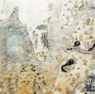
Five ancient maps of Thailand, dating back as far as 1782 will go on display this month at the Jim Thompson Art Center in an exhibition entitled "“Siam in Trade and War -– Royal Maps of the Nineteenth Century"”. Thai Day reports that the maps are part of a a group of 17 maps discovered at the Grand Palace back in 1996.

Hand drawn and colored on cotton, the maps cover Siam, Burma, Cambodia and China. The maps are reportedly rich in detail depicting a country studded with temples, trees and forts. The lakes and rivers are shown filled with fish and Chinese junks.

Not only are the maps beutiful, but they are historically important as well. "“These maps represent primary sources of information for the study of Siamese and Southeast Asian history and geography for years to come,"” Santanee Phasuk, one of the exhibition's co-curators told Thai Day.

The maps are a unique find in Thailand as only one other topographical map from the era is known to exist. Narisa Chakrabongse, another co-curator explained why. "“Maps at that time were trade secrets, and only big companies such as the Dutch India company would have them." However European maps of the area concentrated on shipping routes, with sparse information on the interior. Researchers have confirmed that topographic maps' are highly accurate for their time.

Thai Day explains how the maps were dated:
To pinpoint when the maps were drafted, the researchers used orthography (the examination of written letters in ancient manuscripts), looking at their tone marks, the handwriting and the spelling. They found that the style of the maps differed from Thai nineteenth-century painting, with its rich and varied coloring. Other characteristics are animals in natural environments and elaborate architecture.
Exhibition of the maps runs from January 28 to March 31.

Jan 22, 2006

Map Finds Many In Sacramento At Risk Of Flood

Combining data from the U.S. Census with flood maps, the Sacramento Bee concluded that more than 150,000 of Sacramento County's elderly, poor and disabled, live in areas prone to substantial flooding and could face difficulty evacuating in times of serious flooding.

The Bee matched a flood map from the state Department of Water Resources with U.S. Census 2000 tract data. The paper included any census tract where most of the land would be covered by at least 2 feet of water. Census data listed 183,000 vulnerable people living in flood-prone areas. However, since some people were counted in more than one group, for example being both elderly and poor, the Bee used Census and other data to reduce its estimate of people vulnerable to flooding to 150,000.

Local officials acknowledged the problem but admit they have no firm plans for evacuating the disabled and elderly in case of a major flood. "We simply don't have enough resources to adequately evacuate all these people," said Carole Hopwood, retired manager of the Sacramento County Sheriff's Department Emergency Operations Division.

The Bee reports that no city in America is at greater risk of a catastrophic flood than Sacramento.

U.S. Gives South Korea Digital Map

The United States National Geospatial-Intelligence Agency, promised to deliver "digital topography intelligence" to South Korea. The Korea Times quoted an unnamed official in Seoul as saying that the U.S. would give the map to Kim Jang-soo, South Korean Army chief of staff, during his visit to Washington last week.

The digital map, which was drawn using the U.S. military's latest satellite images is said to contain information, that could be used "in times of emergency'' to conduct surgical strikes. South Korea remains technically at war with its communist neighbor, North Korea.

The South Korean Army has an outdated version of the digital map, which also was provided by the United States in 1993. The unnamed official said that it has not been updated since.

The South Korean Air Force had planned to import a military software, named Digital Point Positioning Data Base (DPPDB), from the U.S. to enhance its ability of attacking underground bunkers. However, the effort had run afoul of U.S. laws that govern exports of high tech software.

Jan 20, 2006

The Errant Isle of Manhattan

A post in Gothamist features a, "Map of the Day."
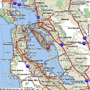
Today's map comes from Radical Cartography, source of the popular subway comparisons from a couple of days back. In this map, entitled "The Errant Isle of Manhattan", Bill has superimposed the map of Manhattan into other geographies, including Chicago (seen above), the Bay Area, and Philadelphia. It's fun to check out the sense of scale-- our little island is pretty small compared to some of these other cities.
I especially like the one with Manhattan sitting in San Francisco Bay, which I reproduced at left. "Radical Cartography"? Wish I'd thought of that name.

Jan 19, 2006

Replica Of Boat Used In Historic Expedition Completed

A replica of the 30-foot shallop used by Captain John Smith to make his historic 1608 exploration of the Chesapeake Bay was unveiled at a ceremony yesterday. The boat. which was built using 17th century tools and construction techniques, will be exhibited at the Maryland State House and then in museums throughout the U.S. and England this year.

On May 12, 2007, the 400th anniversary of the establishment of the Jamestown Settlement in Virginia, the shallop and a crew of 14 will embark on a 127-day, 1,500-mile reenactment of Smith'’s historic expedition. As posted previously, Smith's expedition resulted in a map, of the Chesapeake Bay area, which was published in England in 1612. The map is a valuable snapshot of what the bay looked like at the time of the first European contact.

One question that remains about Smith's incredible exploration is how did he cover so much of the Nanticoke River in so little time? Smith's records seem to indicate that he made the voyage, preparing a detailed map of both sides of the Nanticoke River, in just three days, while many of his crew were ill. It will be interesting to see how much of the river a modern-day crew can cover each day.

FEMA Issues Mississippi Topographic Maps For Katrina Rebuilding

The Federal Emergency Management Agency (FEMA) has teamed up with the National Oceanic and Atmospheric Administration (NOAA) to develop a series of topographic maps for Mississippi Gulf Coast counties. The maps are intended to help property owners meet FEMA'’s advisory elevations in their rebuilding efforts following Hurricane Katrina.


Back in November, FEMA posted its Advisory Base Flood Elevation (ABFE) maps for the three Mississippi counties along the gulf coast online. The agency urged local governmentss to adopt the new elevations to govern rebuilding efforts and urged property owners to adhere to the new higher elevations as well. However, one of the most frequently heard complaints about the maps were that they only provided the elevation above sea level new structures should be built. Without knowing the ground elevation of a particular property, it was impossible for a property owner to determine how high above the ground he would need to rebuild.

To address this problem, the two government agencies have released the topographic maps for comparison with the ABFE maps. To determine approximately how high new buildings should be constructed, a property owner should go to the introduction to the maps here. Then choose the link for the appropiate county and find their property on the ABFE maps. Then the same property can be located on the topographic maps where the existing ground elevation can be found. By subtracting the existing elevation from the recommendedd elevation (ABFE), a property owner can determine approximately how high above the ground FEMA recommendss new structures be built.

FEMA cautions that the topographic maps are for advisory purposes only and advises property owners to have an official site survey done by a licensed surveyor or engineer for local permitting purposes. However, the new maps should be adequate for preliminary estimating of the effort involved in complying with the new advisory elevations.

Firm Completes 3-D Map Of California

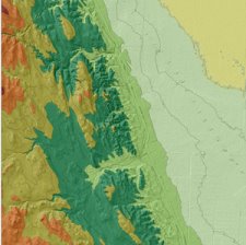
Denver-based Intermap Technologies Corporation announced today that it has completed a new digital three-dimensional map of the state of California. The firm says that the map is the most accurate three-dimensional color map ever produced of the state.

Intermap intends the map for applications such as: geographical information systems (GIS), engineering planning, transportation, automotive, navigation, flood, irrigation, environmental management and planning, telecommunications network planning, aviation, simulation and 3D visualization.

The firm plans to complete maps of Texas, Oklahoma, Arizona, New Mexico, as well as complete a map of Germany by the end of the year. The firm eventually plans to map the entire United States.

Jan 18, 2006

Report: GLONASS Could Be Operating By 2009

GLONASS, the Russian global navigation satellite system could be ready by 2009, ahead of the originally planned date of 2012, the Russian News and Information Agency reported today. Russian Defense Minister Sergei Ivanov, made the report to President Vladimir Putin after conferring with officials of the Russian Space Agency and the Federal Agency for Industry.

Back in December, President Putin said that he wanted the timeline for Russia's program speeded up. He made the statement as the European Space Agency was preparing to launch the first of its navigation satellites. The defense minister said that by accelerating the program, GLONASS could be put into operation in Russia by 2007, with limited global use following in 2009. The cost would be $53 million this year.

Curing Americans' Cluelessness

Roger Andresen is a man on a mission. Scripps Howard News Service reports that the former fiber-optic engineer is determined to cure American's geographic ignorance:

"I went out and gave a simple geography quiz to 400 people on the streets of Atlanta, and they all realized they were pretty bad at it," Andresen says. "Then I asked them, 'Do you care?' And I found out that a lot of people weren't happy about it."

It looks like Mr. Andresen has his work cut out for him. A study of Americans ages 18 to 24 found:

  • 11% couldn't locate the United States on a map.
  • Almost 30% couldn't find the Pacific Ocean.
  • Among 3,000 people surveyed in Canada, France, Germany, Great Britain, Italy, Japan, Mexico, Sweden and the U.S., the U.S. scored next to last in geographic literacy .

To combat American's geographic ignorance, Mr. Anderson started, A Broader View. The firm sells The Global Puzzle, a jigsaw puzzle which is a map of the world whose pieces are shaped like the countries of the world. He also has a website, The Geography Zone, which features a geography quiz game designed to make the subject fun for kids.

Mr. Anderson should be commended for trying to increase kid's knowledge about the world, but he might want to consider another tactic - reality TV. A recent survey found that while just 13% of young Americans could locate either Iraq or Iran. They were much more likely to know that the island featured in the reality show "Survivor" was in the South Pacific.

Jan 17, 2006

More Questions Surface Over Chinese Map

More questions have arisen over the map that purports to be a 1763 copy of a map made in 1418 that supporters have said prove that the Chinese sailor Zheng He circumnavigated the globe and during his voyage discovered America.

The International Herald Tribune has a story that sheds more light on some of the troubling details of the map that has caused some historians to question its authenticity.

In the article, Gong Yingyan, a historian at Zhejiang University and a leading map expert, says the map is too full of anachronisms to date from the 15th century. As an example, Mr. Yingyan says that Chinese cartographers did not use the style of projection seen in Liu's map - a three-dimensional globe on a flat sheet - until much later when they were introduced to the technique by Europeans.

The Chinese map expert also said:
The map's Chinese notes about the cultures, religious and features of people in the continents of the world also contain vocabulary that would have been unfamiliar to a reader in the early 15th century, he said. He cited the term the map uses for the Western God, which he said was not used until after the Jesuits arrived in China in the 16th century.
One final consideration is the fact that last year, China's Communist government celebrated the 600th anniversary of Zheng He's voyages. However, Beijing, which has never been known to shy away from trumpeting China's achievements, did not promote the idea that He circled the globe or discovered any unknown continents.

See previous posts:
Did Chinese Discover America?
Did Chinese Discover America? No Says Professor

MapBiz: GlobeXplorer Signs Deal With EPA

The photogrammetry and satellite imagery firm, GlobeXplorer announced today that it had reached an agreement with the U.S. Environmental Protection Agency (EPA) to make its earth imagery and map data available to all of EPA's staff nationwide. Aerial, satellite, and map data will be available to the agency through the firm's ImageConnect extensions for Geographic Information Systems (GIS) software.

The EPA uses GlobeXplorer's data in some of its projects already, including Superfund site work, wetland analysis, pesticide analysis, endangered species protection and emergency response.

ImageConnect extensions, which are available for several computer drafting and GIS software packages, allow users to access GlobeXplorer's archive of geo-referenced imagery inside those applications without conversion.

A subsidiary of Stewart Information Services Corporation, GlobeXplorer says it owns the largest commercial library of aerial photos, satellite imagery, geographic maps, and real property information in the world.

Jan 16, 2006

If I Had A HAMMER...I'd Map The World

A New Zealand company called Surveylab, has licensed technology developed by the U.S. Army to produce an all-in-one mapping tool. The device, which the Army calls HAMMER, for Hand-held Apparatus for Mobile Mapping and Expedited Reporting combines a Global Positioning System (GPS) receiver with a hand-held iPaq computer, a digital camera, compass, laser distance meter, inclinometer and Geographic Information System (GIS) software in one portable device.

Surveylab is marketing the device under the name ike to the real estate, civil engineering, and land surveying markets. The firm says that a key benefit of the unit is that having on-board GIS software allows the different kinds of information collected be integrated easily in a database, shown to a map, or turned into a report.

The device was originally developed by the Army's Construction Engineering Research Lab for an expansion at Fort Irwin, California. The area is the site of several ancient Native American archaeological sites. Officials involved in the expansion wanted a system that would predict where historic sites might be located on the fly.

About 150 of the units have been used by the Army and the Army Corps of Engineers in such places as Iraq and Afghanistan for projects such as laying out camps and recording environmental conditions. The Urbana/Champagne News-Gazette has a story on how the corps is using the unit to assess damage from hurricane Katrina.

Did Chinese Discover America? No Says Professor

A map recently promoted as proof that Chinese sailor Zheng He discovered America during a voyage around the world in the early 1400s was likely made in the last 20 years, not in 1763, a Chinese historian stated today. Mao Peiqi, a professor of history professor at Renmin University, who has seen a copy of the map, told Interfax that he found clear errors which show the map maker didn't understand 18th century China. "The map is a fake and was made in the last 20 years," Mr. Peiqi stated at a press conference in Beijing on Monday.

As posted preciously, the map is claimed to be a 1763 copy of a map originally made in 1418. Samples of the map have been sent to the United Kingdom for carbon dating. However, the carbon dating will only show whether the map is a modern forgery. Even if the tests prove it was drawn around 1763, it could still be an antique fake.

Jan 15, 2006

Rare Maps Going Digital In Response To Thefts

Last summer's arrest of map dealer E. Forbes Smiley III, for the theft of several maps from Yale University is still impacting the nation's map libraries. The Hartford Courant has the story:
Smiley's arrest has put some of the nation's top institutions on edge, forcing them to walk an ever finer line between protecting their priceless treasures and making them available to geographers, scholars and the public. In the weeks after Smiley's arrest, the Boston Public Library, the Newberry Library in Chicago and the British Library in London discovered that rare books handled by the Martha's Vineyard map dealer were also missing maps. Other spots Smiley frequented - Harvard University, the New York Historical Society and the New York Public Library - are still reviewing their collections.
But if there is a silver lining to the thefts, it may that ultimately, many of the world's rarest maps may actually become more accessible to the public - in digital form. The Courant explains:
Once the inventory has been done, Yale may follow the lead of the Library of Congress, the British Library, Harvard and others, in digitizing its rarest material. Anyone with a computer can now view the Library of Congress' $10 million crown jewel, Martin Waldseemuller's 1507 world map, the first to use the word "America," or turn the pages of an atlas of Europe, at the British Library, drawn in the 1570s by Flemish cartographer Gerardus Mercator.

Libraries are digitizing their maps, first, to make their collections more accessible. But there are security benefits, too. By making high-resolution images available, libraries can limit the number of people handling their material, reducing the chance of theft. Second, if a map is stolen, libraries can circulate a picture of it among dealers, to alert them. And finally, if the stolen map later turns up, libraries can compare the stains, creases and imperfections of their original against the scanned image of the stolen maps to help prove ownership.

"It's undoubtedly the wave of the future," said George Ritzlin, a rare map dealer in Evanston, Ill. "No two copies are exactly the same. It should be a warning to thieves."
Increased access to high quality scans of rare maps is even leading to new discoveries. William Reese, a prominent rare book dealer told the Courant, "People are discovering, every day, differences in maps people weren't aware of before. It's going to be a tremendous aid for scholarship."

Jan 14, 2006

Cell Phone Maker Takes Stake In GPS Firm

A division of Motorola, Inc., the giant communications company, has made an investment in Global Locate, a firm specializing in Global Positioning System (GPS) technology, Motorola announced yesterday. Financial details of the deal were not announced.

Based in San Jose, California, privately owned Global Locate's GPS technology is widely used in the mobile wireless industry. The company's IndoorGPS(R) technology is used in mobile wireless devices, including handsets, smartphones, PNDs, Two Way Radios, and Automotive applications.

A Fortune 100 company, Motorola reported sales in the U.S. of $31.3 billion in 2004 of its communication devices, primarily radios and cell phones. Reading between the lines, it would seem that Motorola is making a bet on the increasing popularity of GPS-enabled cell phones and other devices. Warren Holtsberg, corporate vice president for equity investments at Motorola seemed to say as much when he said, "Global Locate's technology is highly complementary with Motorola's vision of seamless mobility and we are pleased to support the company with this strategic investment."

European Space Agency To Go Forward With Next Phase Of Galileo

The European Space Agency (ESA) will sign a 950 million euros (about $1.15 billion) contract with Galileo Industries GmbH for the next phase of its Galileo navigation satellite program on January 19th, the agency announced yesterday.

The ESA says that the contract, "will pave the way for the operational deployment of Galileo." The ESA launched it's first satellite on a Russian rocket on December 28, of last year. That satellite is currently in its in-orbit validation phase. The ESA plans another launch this spring.

This new contract will give the European agency a total of four satellites, the minimum required to guarantee precise positioning and synchronisation. Following in-obit validation of those four, the agency plans to launch an additional 26 satellites for a total of 30 satellites. The Galileo program is intended to end Europe's reliance on, and offer a commercial alternative to, the American GPS system, which is currently the only system fully operational.

Mapping Cougar Sightings Online

I access local government GIS maps and information via the web almost everyday at work. Of course, the sophistication and level of detail varies greatly. Some are basically street maps posted online, others go into detail, linking a great deal of information. One I've seen even tells you what day the garbage is picked up at a particular location with a mouse click. So it takes something really different to catch my attention. Jackson County, Oregon caught my attention with their online map of cougar sightings. That's right, cougar sightings. I'm not positive, but I'm betting the county can boast that it sponsors the only online map of cougar sightings in the country, possibly even the world.

Story by Mail Tribune.

U.N. Ambassador Formally Protests Removing Israel From Map

The United States' Ambassador to the United Nations has complained to U.N. Secretary-General Kofi Annan about a U.N. event where a map of pre-1948 Palestine, an area that now comprises the state of Israel, was displayed. As posted previously, the UN-sponsored, "Day of Solidarity with the Palestinian People" displayed a, "Map of Palestine" from which the nation of Israel had been expunged. In a January 3rd letter, a copy of which was obtained and reported on yesterday by Reuters, U.S. Ambassador John Bolton said, "It was entirely inappropriate for this map to be used. It can be misconstrued to suggest that the United Nations tacitly supports the abolition of the state of Israel. Given that we now have a world leader pursuing nuclear weapons who is calling for the state of Israel to be 'wiped off the map,' the issue has even greater salience." According to Reuters, the Secretary-General's office was preparing a response to the letter.

Jan 13, 2006

Mapquest Leaves Alberta's Capital Off Map

The popular mapping service, Mapquest recently printed a map of Canadian cities and towns. There's just one small problem, or perhaps a big problem, depending on where you live. The Edmonton Journal reports that Edmonton, the capital city of Alberta is missing. The city does get a circled star, but there is no name on the map to identify what it is.

So far, no one at Mapquest has responded to the Journal with an explanation for the mistake. The issue brings to mind recent stories about Apple's headquarters not showing up on Microsoft's new maps and the fact that Google Earth is centered on Kansas University, the alma mater of the head engineer. Perhaps someone at Mapquest hates the NHL Oilers?

Mapping For The Masses: GPS Market At $22 Billion By 2008

Back in the early 1980s, Trimble Navigation made a fateful decision. The firm, started in Silicon Valley by former employees of Hewlett-Packard, decided to focus its efforts on developing civilian applications of Global Positioning System (GPS) technology, then being deployed by the U.S. military. The decision proved fortunate for Trimble, which has grown to a company with 2,000 employees and reported third quarter 2005 revenues of $188.5 million.

But could anyone have imagined that the once rather obscure and expensive technology would become such a huge industry? Research and Markets, recently began tracking the worldwide GPS market. The firm recently issued a market research report that estimates that the worldwide GPS market will reach a value of about $22 billion by 2008. The firm predicts that the main source of the sales increase will come, not from professionals, but from recreational users.

During the past year there was talk of, "mapping for the masses", the idea that modern technology have made cartography and navigation available to everyone. If current predictions are correct, this trend will grow exponentially over the next few years.

Jan 12, 2006

Did Chinese Discover America?

New evidence is about to come forward to support the theory that the world and its continents were discovered by a Chinese admiral named Zheng He between 1405 and 1435.

The Economist has the story:
Next week, in Beijing and London, fresh and dramatic evidence is to be revealed to bolster Zheng He's case. It is a copy, made in 1763, of a map, dated 1418, which contains notes that substantially match the descriptions in the book. “It will revolutionise our thinking about 15th-century world history,” says Gunnar Thompson, a student of ancient maps and early explorers.

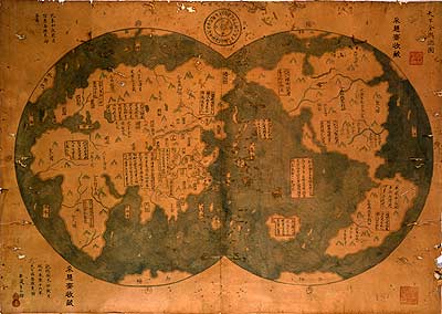
The map (shown above) will be unveiled in Beijing on January 16th and at the National Maritime Museum in Greenwich a day later. Six Chinese characters in the upper right-hand corner of the map say this is a “general chart of the integrated world”. In the lower left-hand corner is a note that says the chart was drawn by Mo Yi Tong, imitating a world chart made in 1418 which showed the barbarians paying tribute to the Ming emperor, Zhu Di. The copyist distinguishes what he took from the original from what he added himself.
Some of the features of the map:
The detail on the copy of the map is remarkable. The outlines of Africa, Europe and the Americas are instantly recognisable. It shows the Nile with two sources. The north-west passage appears to be free of ice. But the inaccuracies, also, are glaring. California is shown as an island; the British Isles do not appear at all. The distance from the Red Sea to the Mediterranean is ten times greater than it ought to be. Australia is in the wrong place (though cartographers no longer doubt that Australia and New Zealand were discovered by Chinese seamen centuries before Captain Cook arrived on the scene).

The commentary on the map, which seems to have been drawn from the original, is written in clear Chinese characters which can still be easily read. Of the west coast of America, the map says: “The skin of the race in this area is black-red, and feathers are wrapped around their heads and waists.” Of the Australians, it reports: “The skin of the aborigine is also black. All of them are naked and wearing bone articles around their waists.”
Skeptics point to the map's precision as evidence that the map is not a copy of the 1418 original but from a later time. Supporters argue that the map is consistent with what the Chinese knew about geography at the time. An interesting feature of the map are the errors, errors which later showed up on European maps. The map depicts California drawn as an island, an error that would later appear on European maps. The has led some to suggest that Europeansrporeans copied their maps from the Chinese.

Authentication of the map would mean that the new world was first discovered by Chinese and not European explorers would mean a major revision of world history as we know it. We might even have to rename Columbus Day to Zheng He Day.

In The Aftermath Of The Tsunami, One Island Grows, Another Sinks

The recent anniversary of the devastating Indian Ocean tsunami brought back images of vast areas of coastline engulfed by water. But the Times of India reports on a situation in the Andaman Islands that has puzzled experts. When the killer waves receded there, officials discovered that large areas of land had been added to the north side of the archipelago.

About 140 hectares (approximates 346 acres) of land has literally risen from the sea. Local authorities are consulting with the Geological Survey of India about the suitability of the new land for development.

Meanwhile, on Nicobar Island, the exact opposite is occurring. There, authorities report that the island appears to be tilting. This has submerged large areas of the island, turning what were previously forests into swamps.

Andaman officials are considering using their newly acquired land as a tourist resort. Local authorities on Nicobar say that they will probably turn their new swamps into fish farms.

Jan 11, 2006

MapBiz: NAVTEQ To Buy Mexican Mapping Firm

NAVTEQ, one of the two largest providers of digital mapping data for the popular online mapping services announced its intention today to acquire the Mexican business unit, gedas MapIT. gedas MapIT, a division of gedas Mexico is the leading digital map provider in Mexico. Navteq says it made the deal to broaden its digital map coverage and to provide a base for future growth.

As part of the deal, NAVTEQ will get a production facility in Leon, Mexico as well as a facility in Mexico City. The company says it plans to merge the Mexican geographic coverage with its existing maps by the end of the year.

USGS Mapping Center Appears Headed To Denver

It appears the United States Geological Survey (USGS) will be consolidating its National Geospatial Technical Operations Center (NGTOC) in Denver. The government's mapping agency has released the results of its review of the decision to consolidate operations in Denver. In a summary memorandum transmitted along with the 41-page report, acting director P. Patrick Leahy said, "the process leading to the site selection for NGTOC was open, fair, and adequate to support the decision."

The memo did admit the site selection could have been handled better however. The review found, "...weaknesses in the coordination of internal communications throughout much of the process leading to the announcement of a site selection contributed to employees having assumptions and expectations not supported by the full documentation and those communications could have been improved."

In January of 2005, USGS announced plans to consolidate its four mapping centers into the NGTOC. Last September, Denver was announced as the choice for NGTOC. The decision meant that mapping centers in Rolla, Missouri, Reston, Virigian, and Menlo Park, California, would be closed. When some Missouri politicians complained that the process was unfair to Rolla, and would cost the rural community 200 jobs, USGS decided to review the decision.

With that review complete, USGS appears ready to move forward with consolidating operations in Denver. The Rolla Daily News reports that USGS Director Leahy has directed Karen Siderelis, associate director for Geospatial Information, to resume the process of consolidating the geospatial operation and production functions in Denver and resume the A-76 competitive sourcing process.

Some of Missouri's representatives remained unimpressed and vowed to continue fighting the move. U.S. Rep. Jo Ann Emerson told the News. “Even though we feel like the door has been slammed in our face, I want to try to open that door once again. I want to review the paperwork regarding the USGS internal review, which has not yet been provided to me, and I want to see the outcome of the Inspector General’s investigation.”

Denver vs. Rolla


Phelps County, MO (Rolla)

Denver County, CO

Population

39,825

554,636

% W/Bachelor’s Degrees

21.1%

34.5%

Median value of homes

$74,800

$165,800

Median household income

$29,378

$39,500

% below poverty line

16.4%

14.3%

Source: U.S. Census

Jan 10, 2006

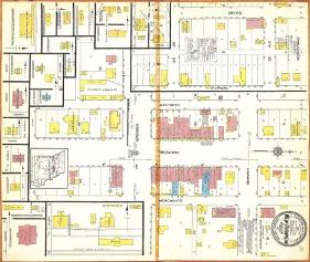
Town receives Historic 1917 Sanborn Map

The New Franklin, Missouri Board of Alderman were recently presented with a 1917 Sanborn Insurance Map of the city. The Boonville Daily News reports that the map was donated to the city by Councilman Walter Banks. The map has been scanned and a copy is available on CD, while the original will be archived. Interestly, the News reports that the compass rose on the map is pointing in the wrong direction.

Beginning in 1867, the Sanborn Map Company produced maps covering approximately 12,000 cities and towns in the United States, Canada, and Mexico. They were primarily designed to assist fire insurance agents in assessing risks. They show the size, shape, and construction of dwellings, commercial buildings, and factories, as well as building details, streets, property boundaries, addresses and utility information.

Sanborn maps provide a wealth of historical information about North American cities. The Sanborn collection is comprised of approximately 7,000 individual maps. The largest collection of Sanborn maps is in the Library of Congress.
Scientist Who Mapped Ocean Floors Dies

William F. Haxby a scientist whose maps of the ocean floor formed the basis for studies of the ocean floor for two decades has died. Newsday has the story:
William F. Haxby, a scientist who used satellite measurements to produce the first detailed maps of the ocean's floors, has died. He was 56.
William F. Haxby, an earth scientist at the Lamont-Doherty Earth Observatory at Columbia University, used computers to process data from satellites and other devices to create images detailing the makeup of the ocean bed.

In 1983, he created what several ocean scientists described as a "gravity field" map of the world's oceans, which was one of his biggest contributions to his field. Haxby processed measurements of the height of the sea surface collected by satellite to map the ocean bed.

Garmin Makes GPS Available For Mac; Adds GPS To Rental Cars

A couple of announcements from Garmin today.

First, the GPS firm announced at the big Apple convention being held in San Francisco that it will start making its line of GPS devices compatible with Mac OS X version 10.4 "Tiger." Garmin is the first major GPS manufacturer to announce direct support for Mac OS X. Starting in the spring, Garmin will offer a Mac version of its popular fitness software packages. The plan is to have all its hardware and software products Mac compatible by the end of the year.

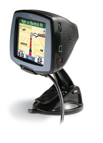
Second, the company announced a deal with Enterprise Rent-A-Car, to offer a customized version of its StreetPilot c340 GPS navigation unit in the company's rental cars. Enterprise says the unit will cost you $7.95 a day.