

Gulf Coast Navigation Charts Posted Online
 Almost five months since Hurricanes Katrina and Rita struck the Gulf Coast, ports on the gulf and channels on the Mississippi River are still finding obstructions in the water and new areas of shoaling that pose a danger to shipping.
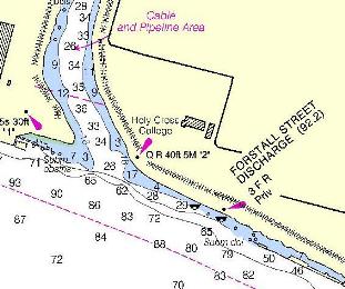
To help speed the recovery effort, the National Oceanic and Atmospheric Administration's (NOAA) Office of Coast Survey has launched the Coast Pilot Disaster Impact web site. The web site features maps of currents conditions at 21 port facilities along the Gulf Coast impacted by Hurricanes Katrina and Rita. The maps include information on: pilotage, channel, side and approach depths, anchorages locations, obstruction hazards, bridge information, storage and supply facility information, overhead or surface bottom cabling, small craft facilities, status of wreck removals, and wharf information.
The site also has a link to allow port facility managers to send information on underwater obstructions and other hazards directly to the Office of Coast Survey. The Office of Coast Survey will then post the information on the web to alert other ships.
The navigation charts can be found here.
posted by Roger Hart @ 1/30/2006
|
![]()
![]()


<< Home