

New Version Of NOAA's NowCOAST Web Mapping Portal Features Real-Time Data
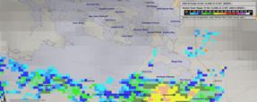 The National Oceanic and Atmospheric Administration (NOAA) has launched an updated version its nowCOAST web portal. NowCOAST uses Geographic Information System (GIS) technology that allows users to overlay other datasets and NOAA forecast products with these on-map displays to get a detailed picture of present conditions. The improved web mapping portal now features coastal observations and NOAA forecasts in real-time. This latest version also allows users to view the latest Geostationary Operational Environmental Satellite cloud imagery, and NOAA National Weather Service weather radar images.
The new mapping portal also includes geo-referenced hyperlinks to observations from river and water quality observing networks, coastal Web cams, as well as NOAA marine and weather forecasts and forecast guidance from NOAA weather, ocean, estuarine, and river computer prediction models. NowCOAST includes an interface to accommodate both novice and experienced GIS users to allow both to quickly view real-time environmental conditions for any U.S. coastal area.
See also:
Gulf Coast Navigation Charts Posted Online
Labels: Government Agencies
posted by Roger Hart @ 3/10/2006
|
![]()
![]()


<< Home