GeoCarta Has Moved

Dec 29, 2005

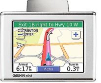
Beyond The Simple GPS Navigator

Joel Arellano sounds confident in his post to Autoblog titled, "GPS won't replace common sense, maps." But the competitors in The Grand Challenge have other ideas about the potential for computer-aided navigation.

A Very Different Sort Of Race
As Scientific American reports, the contest, which was sponsored by the U.S. Defense Department, was a 132-mile race for driverless vehicles. Held in the Mojave Desert in March 2004, it featured a prize of $2 million for the winner.

Five auton­omous vehicles finished the course, four of them navigating the 132-mile course in less than the 10 hours required to be eligible for the prize. These are not remote-controlled cars, these are cars, and some trucks, that actually drive themselves, steering their course with on-board computers.

GPS Plus
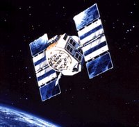
Not surprisingly, every contestant in the Grand Challenge was equipped with differential GPS receivers, but most teams added other tracking systems to their robots, typically inertial navigation systems.

However, two of the teams created technologies that look promising:
  • A team of high school students from Palos Verdes, California installed a bright lamp in their robot and directed the light onto the ground. A camera aimed at the bright spot picks up motion in any horizontal direction, acting as a two-dimensional odometer. The team called their system, "The GroundMouse."
  • A team of professional engineers from Ford, Honeywell, Delphi and Perceptek, used a similar technique on their pickup truck. A radar aimed at the ground senses Doppler shifts in the frequency of the reflected beam. The robot then calculates relative motion so that when the it loses the GPS fix on its location it can fall back on dead-reckoning navigation from its radar odometer.
The Road Ahead
But it's not enough to plot a course from Point A to Point B. To be truly "driverless" a vehicle has to be able to adapt to road conditions. To accomplish this, the teams used laser scanners. By sweeping an infrared laser beam in front of the vehicle, the scanner creates a three-dimensional image of the road ahead. The teams used various configurations of laser scanners to help their robot, "see" the road ahead.

Winning Technology
The competition, and the $2 million was won by a team from Stanford. The differenc for the Stanford team was its vision-based speed switch. That simple tool allowed the robot to speed up whenever it saw a smooth stretch of road in front of it. However, some of the most promising technology appeared on vehicles that failed to finish.

Since the vehicles didn't actually drive themselves solely with GPS, Mr. Arellano is technically correct. But with strong military and commercial interest in the technologies that were developed, it looks like many of the teams will go full speed ahead.

Newspaper Chain Uses Map To Dispute Assumptions About New Orleans Dead

The Knight Ridder newspaper chain has been doing some, "investigative mapping" of the dead in New Orleans after Hurricane Katrina. All the chain's papers are carrying the same story, but you can read it in the Contra Costa Times. Here's what they did:
The addresses where bodies were recovered were compiled by Louisiana state officials and released earlier this month. Knight Ridder charted the locations on a map of Orleans and St. Bernard parishes, then compared them with census data on income in those neighborhoods. The analysis excluded 216 bodies that were recovered from hospitals and nursing homes, as well as 63 recovered at collection points where people had dropped off bodies in the days after the storm; those victims probably came from locations other than the census tracts where they were found.
While data about all of the victims in New Orleans has not been released, here's what the newspaper chain concludes thus far about the victims:
  • They weren't disproportionately poor.
  • They weren't disproportionately African-American.
  • They were disproportionately old.
  • Many did in fact, have access to their own transportation, but apparently chose to ride the storm out.
  • About 67 percent of the mapped deaths fell in the central and western portion of the city, an area thought to have flooded primarily because of the failure of man-made structures.

It would have been nice for Knight Ridder to have actually published their map. So far, I've not been able to find it. I guess that's to be expected from a media company that is still publishing on paper.

Man Sues, Claiming Map Error Cost Him His Land

Clark Cook had a deal to sell two acres of his deceased father's property in Liberty, Pennsylvania. So imagine his surprise when a review of the Tax Assessor's Map revealed that he didn't own the land.

According to a story in the Pittsburgh Tribune Review, the land in question had already been acquired through eminent domain by the South Allegheny School District. The only problem was that the school district didn't compensate Mr. Cook, who claims to be the rightful owner. Instead, the school district had paid $80,000 for the land to the family of Lucy A. Williams. Ms. Williams was shown as the owner on the county Tax Assessor's Map.

So Mr. Cook has filed suit against the county and the school district, claiming that the county mistakenly assigned him a different piece of land when it changed its assessment system in the 1970s.

For The Road Warrior That Has Everything

If Santa left you one of those new Global Positioning System (GPS) navigation units that tells you what roads to take and where to turn, congratulations. But if you're already getting tired of the same old computer generated voice telling you how to navigate the streets and highways, you may want to check out what's new from Navtones.

Station KSL reports that the company offers celebrity voices for your GPS navigation unit for about $10. Currently you can have Mr. T, Burt Reynolds, or Dennis Hopper give you driving directions. Mr. T? Apparently the company uses the term, "celebrity" pretty loosely.

Dec 28, 2005

Europe's First GPS Satellite Launch A Success

The European Union took its first step towards challenging American and Russian dominance of the skies with the launch its first Galileo navigation satellite on Wednesday. Reuters quoted the Russian space agency Roskosmos as saying that the satellite named Giove-A (Galileo In-Orbit Validation Element) went into its orbit 23,000 km (15,000 miles) from the earth after its launch on a Soyuz rocket from the Baikonur cosmodrome.

The satellite is the first of a planned 30 satellites planned that should end Europe's reliance on the American GPS as well as compete with the system run by the U.S. military. Russia currently has 19 of a planned 24 satellite constellation in orbit. Both are projected to be operational by 2008, though Russian President Vladmir Putin recently urged his country to speed up their program.

See previous post: World Prepares To Challenge U.S. Dominance In GPS.

USGS Puts Landsat Data Online

The U.S. Geological Survey (USGS) has made selected Landsat 4, 5 and 7 satellite data available online at no cost. Orthorectified Landsat data are available for download from the Global Visualization Viewer and Earth Explorer.

The Landsat Orthorectified data collection is a global set of high-quality, relatively cloud-free orthorectified Landsat 4-5 Thematic Mapper and Landsat 7 Enhanced Thematic Mapper Plus imagery. The datasets were selected and generated through NASA's Commercial Remote Sensing Program, and provide two full sets of global coverage over an approximate 10-year interval (circa 1990 and circa 2000) and total nearly 16,000 scenes. USGS plans to add other data sets as they become available, including the Landsat Orthorectified Multispectral Scanner data set (circa 1975).

Users can download an entire scene, containing all bands, metadata, jpeg and header information in a single zipped format file. For more information go here.

Dec 27, 2005

India Forms Group To Address Google Earth Concerns

The Indian government has formed an, "expert group" to suggest ways Google Earth can safeguard the country's interests SDA Asia reported recently. India, which has strict legal restrictions on satellite images and aerial photographs has been one of the most vocal critics of the online mapping service. In the past, spokespersons for Google have indicated their willingness to meet with Indian officials to discuss their concerns. However, it's not clear if this, "expert group" has contacted Google about meeting yet.

Dec 26, 2005

Galveston Island Sinking Faster Than Previously Thought

Galveston Island is sinking at an alarming rate, probably as much as two feet per century, the Houston Chronicle reported recently. Recent readings at a tide gauge show that the water level has risen more than a foot over the last 50 years. Galveston Island is located along the Texas gulf coast, southeast of Houston. The island is home to about 60,000 residents.

Cause
Scientists say much of the sea level rise can be traced to three factors:
  • Subsidence. Primarily from oil and gas extraction.
  • Compaction. Sediments thousands of feet below ground are pressed down.
  • Faulting. It is believed that the coastal areas are slowly are sliding toward the Gulf of Mexico Basin.
Effect
Most estimates say that Galveston Island will sink another two feet over the coming century. If true, the effect could be disastrous, as the Chronicle reports:
The National Hurricane Center recently mapped the effects of a Category 1 hurricane striking the island, moving west-northwest at 5 mph. At its present elevation the entire island, except for the far west end, remained dry.

However, with a 2-foot drop in elevation, nearly the entire island, except for the highest areas behind the seawall, was submerged.

A few years ago scientists with the Environmental Protection Agency simulated the effects of a 2-foot rise in sea level. At high tide, the agency found, a majority of Galveston was under water.

If the island sinks 2 more feet and the waters rise 2 feet this century, most of the island would be uninhabitable.

Solutions
Currently the only effort to protect the island is sand replenishment, where sand is transported from offshore to the coast. In 2007, Texas will receive $240 million from the federal government for rebuilding its coast. Much of the money will be spent on sand replenishment. Other solutions are less popular. A temporary fix might be to prohibit new building within 100 feet of the protective sand dunes. But that would hamper development, especially in the booming west end. Another would be to end the federal flood insurance program that pays to rebuild damaged homes. No one honestly believes that will happen anytime soon.

In 1900, Galveston Island was struck with no warning by a hurricane. That storm, which killed at least 8,000 is still the worst natural disaster in U.S. History. This time the warning signs are abundant. It remains to be seen if they will be heeded.


World Prepares To Challenge U.S. Dominance In GPS

While the United States recently declared its first satellite to feature modernized Global Positioning System (GPS) technology operational, the rest of world tried to catch up in an effort to compete in the growing and strategically important satellite navigation field.

The Russian News and Information Agency announced that the first satellite in Europe's planned Galileo satellite navigation system will be launched on December 28.

Earthtimes.org quoted the Itar-Tass news agency as saying that on Sunday, Russia launched three of its own GLONASS navigation satellites. Today, the Russian News and Information Agency quoted Russian President Vladimir Putin as saying that wanted the GLONASS global navigation satellite system ready before its planned 2008 debut.

If successful, the launch on the 28th will be the first GPS satellite placed in orbit by the European Union. Russia currently has 19 out of their planned 24 GLONASS satellites in orbit. Currently the only fully operational GPS system is run by the United States.

Where Online Maps Meet The Road

In an age where satellite images are available at the click of a mouse, most people may not realize that people still go out and verify and add to satellite data. The San Diego Union Tribune has article on how cartographers at Navteq, Inc. flush out the little details in their digital maps. While everyone seems to have their preference among the various online mapping services, most people don't realize that the underlying data for all of them come from either Navteq or Tele Atlas NV.

The map makers cruise the streets in a small SUV. The vehicle is equipped with a Global Positioning System (GPS) antenna. In the back is a the GPS receiver unit, and a portable power supply. The receiver connects to a video recorder which captures road signs. Up front sits an observer who makes notes of new features on a pen tablet.

The data is later fed into Navteq's computer and included in the quarterly updates it sends to its customers. Each mapping service uses the data to generate its own driving directions which is why two different services may suggest different routes to the same destination. Navteq currently has 514 field analysts driving the streets and highways of North America and Europe to try and keep their maps up to date.


Dec 25, 2005

Texas Wells And Pipelines Go Online

Finding the location of an oil or gas well or pipeline in Texas just got easier. MyWestTexas.com reports that the Texas Railroad Commission has put the location of wells and pipelines in its Geographic Information System data base online. The data includes existing and proposed wells as well as oil and natural gas pipelines.

Despite its name, the Texas Railroad Commission regulates the oil and gas industry in Texas, the top oil and gas producer in the United States. While the well locations should interest the oil and gas industry, of more interest to the mapping professions will be the depictions of oil and gas pipelines. The map can be found here.

Dec 24, 2005

Remembering The Past: Lewis and Clark

Visitors to "Lewis and Clark: The National Bicentennial Exhibition"’ currently at the Oregon Historical Society get an intimate look at two of the greatest explorers and cartographers in U.S. history. According to the Albany Democrat-Herald, the exhibit contains 450 artifacts from their historic exploration of the northwest United States in 1805-06.

Among the items on display are letters, diaries, watches, telescopes, plant samples, a dried woodpecker, a branding iron and even a sewing kit. While such ordinary items may not seem very exciting but the Herald quotes James Ronda, a scholar on their voyage as saying that such things serve to humanize them.

One of the most memorable pieces is William Clark'’s hand-drawn 1806 map. This was the first map to show the Rockie Montains, the Cascades and the rivers of the West. The exhibit contrasts Clark's map with what Mr. Ronda calls "“conjectural geography’," an 1802 map which shows no mountains in the west and a river passage to the Pacific.

Lewis and Clark's expedition was a diplomatic mission, a science mission, but more than anything it was a mapping mission. As Mr Ronda says, "The map is the legacy."

Dec 23, 2005

Maps As Art: English Artist Completes Bird's Eye View Of London Neighborhood

Ham and High Broadway has a story today on the work of artist Malcolm Fowler and his bird's-eye view map of Primrose Hill. Mr. Fowler, who apparently has no cartographic training, prepared his map by simply walking the streets with his sketchbook. He then took each section and compiled them into one map, in pencil and colored it with watercolors and gouache. The map is reportedly very detailed and depicts homes, shops, pubs, restaurants, workshops, and offices, with the London skyline visible.

In preparing his bird's-eye view map, Mr. Fowler is keeping alive a talent that has largely disappeared. In the 1800's such bird's-eye view maps were quite popular, but the demand for such maps virtually disappeared with the introduction of photogrammetry. Mr. Fowler has produced a series of 265 limited edition prints which he is offering for £175 (about $300 U.S.).

Calif. County Delays Action On 1896 Subdivision Map

San Luis Obispo County supervisors Tuesday delayed a decision to allow a developer to use a map recorded in 1896 for developing a 10.6 acre tract with 13 homes the San Luis Obispo Tribune reported.

In delaying the action county supervisors cited two factors:
  • City of Paso Robles officials and neighbors of the project may not have been adequately notified
  • Concern of the precedent such an action would have.

As posted previously, the decision has ramifications far beyond the property in question. It is believed that there are hundreds of such, "antiquated subdivision maps." Validating such maps would allow property owners to use to the old maps in developing their property and greatly restrict planning official's ability to regulate the new developments.


Dec 22, 2005

Lawrence, Kansas: Center Of Google's Earth

"A lot of people think that Kansas is in the middle of nowhere," Boog Highberger, Mayor of the City of Lawrence, Kansas told Journal-World, "I prefer to think that we're in the middle of everywhere. And Google apparently agrees."

Someone, apparently with free time to sit and ponder such things, decided to start up Google Earth, and push the zoom button until they got to a recognizable place. What did they see? Lawrence, Kansas. Technically, the Meadowbrook Apartments, near the campus of Kansas University -- the ultimate center of Google's Earth.

But why Kansas, and specifically, why Lawrence Kansas? Well, a spokesperson for Google explained that it's no accident. Brian McClendon, director of engineering for Google Earth is a 1986 graduate of Kansas University.

"Mainstream" Writer Finds "Mainstream" GPS Unit Too Pricey

As posted previously, this is the year that the makers of Global Positioning System (GPS) navigation units are supposed to go, "mainstream." Today, Wall Street Journal technology writer Walter S. Mossberg reviews the effort of Garmin Ltd. to capture a wider audience with its Nuvi 350. The unit combines satellite navigation and mapping, a built-in music player, photo viewer, U.S. travel guide, audio-book reader, language translator, and currency converter into what Garmin calls a "personal travel assistant."

Among the things he likes about the unit:
  • A good design
  • Simple user interface.
  • Setup requires no technical knowledge.
Among the things he dislikes about the unit:
  • The $900 price is too high.
  • Crude and clumsy navigation.
While Mr. Mossberg lauds the receiver's quick signal acquisition, he mainly faults the unit for its poor driving directions. His conclusion? At the price, it's not worth it.

Complete article from the Wall Street Journal (Subscription required).

New Louisiana Flood Maps A Few Months Away

From WAFB-TV:
Federal officials in charge of Hurricane Katrina recovery said Monday that new flood elevation maps won't be ready until the end of February or into March.

Without knowing that lowest-allowable building level, homeowners and businesses that want to rebuild in southeast Louisiana parishes inundated by Katrina cannot make informed decisions. The flood maps will also determine how much property owners pay for flood insurance.

FEMA spokesman David Passey says an interagency team is working on putting together the much-needed flood maps. Part of that process is waiting for federal funding decisions to be made on how levees will be rebuilt and improved.

Dec 21, 2005

Connecticut Cities Differ On Providing GIS Data

While roughly eight miles separate Stamford, Connecticut from New Canaan, their attitudes about providing Geographic Information System (GIS) data to the public are world's apart. The Greenwich Time reports today on the case of Stephen Whitaker and his quest to obtain such GIS data.

Using the state's Freedom of Information Act, Mr. Whitaker asked the two cities for all digital records from their GIS databases. The data includes aerial photos and detailed maps of the cities. Mayor Dannel Malloy says the City of Stamford intends to comply with the request, stating, "It's part of the public record." City officials did say that they intended to ask their public safety officials if there was anything that should be withheld from Mr. Whitaker, first.

But it's a different story over at New Canaan where First Selectman Judy Neville expressed reservations about releasing of such data, citing security concerns.

This is a familiar road for Mr. Whitaker. Back in 2001, he made a similar request to the Town of Greenwich, Connecticut. In a world recently shocked by 9/11, that request precipitated a contentious debate over access to public records. Back in June, the state Supreme Court finally settled the matter, ruling that officials had to grant access to the city''s images. Greenwich officials provided the data to Mr. Whitaker, but removed maps of manholes, fire hydrants and sewer lines.

It's unclear why New Canaan officials feel the supreme court ruling isn't binding on them, but Ms. Neville said she intended to investigate the issue with other city employees. "I am aware of what happened in Greenwich, but I think Greenwich's system is farther along than ours," the first selectman said.

In the meantime, Mr. Whitaker should be busy. He has filed requests with several other towns. He has appealed Greenwich's decision to edit the data they did provide him to the state Freedom of Information Commission. And he is contesting Greenwich's attempts to copyright the material.


Historic Maps Donated To New Jersey State Archives

Thousands of important documents, including rare maps and land surveys, some dating back to the 1600's and 1700's were donated to the New Jersey State Archives recently. The New Jersey Journal reported that the documents were donated to the state by The Council of West Jersey Proprietors, a 330-year-old group which had held them in vault.

Some of the papers bear rare signatures of William Penn, the Duke of York (later England's King James II) and Sir George Carteret. Among the items donated were a 1719 surveyor's map fixing the location of the common border of West Jersey, East Jersey, and New York at the Delaware River. The map depicts a Lenape Indian village on the banks of the river. West Jersey and East Jersey combined to become the state of New Jersey.

The huge collection also contains:
  • 11 large parchment documents from 1664 to 1763
  • 55 bound volumes of minutes, surveys, warrants and other records dating from 1676 to 1909 surveys from 1680 to the 1900s
  • 52 boxes of rolled maps and plans dating to the 1700s.
A spokesman for the Proprietors Council which made the gift said that the documents include the original papers for virtually every piece of property in West Jersey. Even today, the group is still contacted by attorneys, surveyors and real estate agents, seeking information to help settle property disputes.

The state archives plans to inspect and repairs the documents, then catalogue them and make them available to researchers.

Mississippi Town Ready To Adopt New Flood Maps

Ocean Springs, Mississippi appears ready to adopt the new flood maps issued by the Federal Emergency Management Agency (FEMA) the Pascagoula Mississippi Press reported today. The town's Board of Aldermen passed a resolution saying that it intends to adopt FEMA's Advisory Base Flood Elevation (ABFE) maps and add an additional one-foot elevation requirement.

Pending some fine-tuning of the ABFE maps, and a few additions to the ordinance, the Board of Aldermen said that they plan to formally accept FEMA's new elevation requirements at their next meeting on January 3. "Get the ordinance done and have the other stuff plugged in and give us something to vote on at the next meeting," Aldermen Greg Denyer was quoted as saying.

Ocean Springs appears to be the first local government to adopt the ABFE maps and their higher flood elevations. FEMA released the maps on November 18, and, "strongly urged" local governments to use them in rebuilding following Hurricane Katrina. However, many communities along the gulf coast have resisted adopting the higher elevations, contending that doing so would make rebuilding financial unfeasible.

See previous posts on the gulf coasts reaction to the new flood maps:
Gulf Coast Reacts To New Flood Maps
Mississippi Communities Continue To Resist Adhering To New Flood Maps


Dec 20, 2005

Police Pursue Bank Robber With GPS

The new uses for Global Positioning System (GPS) technology that keep being reported could make a blog of its own. That's why only a few get posted here. However, this item from Channel 5 in Cincinanati looked interesting:
Officers from four agencies are at the scene of a reported bank robbery. Investigators said that a man wearing a black coat and hat, with a large bandage on his nose, walked into the PNC Bank branch at 7435 Kenwood Road just before 10 a.m. and demanded money. The man was last seen leaving the bank on foot. Officers from Madeira, Silverton, Indian Hill and the Hamilton County Sheriff's Office responded to the scene. Investigators are using a GPS tracking receiver to get signals from a device planted in the stolen money. They said the device was heading north at walking speed, or about 2 mph.

Maps In The News

U.N. Ambassador Promises To Look In To Why Israel Was Left Off Map
United Nations Ambassador John Bolton promised to pursue the issue of what he termed, UN-sponsored anti-Israeli campaigns. Ambassador Bolton specifically mentioned the UN sponsored, "Day of Solidarity with the Palestinian People." At the event, there was displayed a, "Map of Palestine" from which the nation of Israel had been expunged.

Story from New York Jewish Times

Four Nations Team Up To Map Important Straits
An international team has completed electronic sea charts of the Malacca Strait and Singapore Strait. The team, comprised of Japan, Indonesia, Malaysia and Singapore, hope that the high-tech maps will reduce accidents and piracy in the key international waterway.

Electronic sea charts, which operate similarly to car navigation systems, can access the charts and display the location of the vessel. They can also sound an alarm if the ship ventures towards shallows or other dangers. This is the first joint effort at mapping international straits.

Story From The Japan Times

Losing Your Land - Part IV

Paul and Denise Przybylo, and their neighbor G. Scott Walling just couldn't seem to get along. They had a series of disagreements over little things that neighbors sometimes fight about -- barking dogs, bright lights, things like that. Perhaps on the theory that if Mr. Walling were out of sight, he'd be out of mind, the Przybylos decided to plant some large trees along the property line between their land and Mr. Walling's.

Unfortunately for the Przybylo's, a survey of the line to determine where the trees should be planted determined that Mr. Walling had been maintaining a strip of their land for more than a decade. Mr. Walling then sued claiming ownership of the land under the legal doctrine of adverse possession. According to the Glens Falls Post-Star, a court awarded the 5,800-square-foot strip of land to Mr. Walling.

The Przybylos case have filed an appeal. They've also convinced New York Assemblywoman Teresa Sayward, to draft a bill that would amend the state's adverse possession law to prevent similar cases.

Google Earth: Complaints and Restrictions

The New York Times summarizes the fears and restrictions on the popular satellite mapping service Google Earth in a story today.

Worldwide Complaints
Among the nations that have expressed security concerns about the service:
  • India- One of the world's nuclear powers, it shares a sometimes tense border with Pakistan, which has nuclear weapons of its own. India has been one of the most vocal critics of the service, saying it could compromise their security. The nation has tight legal restrictions on satellite images and photogrammetry.
  • South Korea - Officially still at war with its communist neighbor to the north, officials there have voiced fears about the level of detail Google Earth's imagery provides of military installations.
  • Thailand - Security officials said they intended to ask Google to block images of vulnerable government buildings.
  • Russia - Having been attacked by Muslim terrorists themselves, the country is uneasy with the service. The Times quotes Lt. Gen. Leonid Sazhin, an analyst for the Federal Security Service,as saying about Google Earth, "Terrorists don't need to reconnoiter their target. Now an American company is working for them."

Misplaced Anger
Overlooked in the rancorous comments is one simple fact. The images in Google Earth were already available commercially. Google's sin, if one could call it that, is in compiling the imagery and making it more readily available over the internet.

Current Restrictions
American companies have been selling high-resolution images since the 1990's, when the U.S. government loosened restrictions. However, there are still a number of restrictions on the data:

  • Images of Israel shot by American-licensed commercial satellites is only available at a relatively low resolution.
  • The United States government can put any area off limits in the interests of national security.
  • Very high-resolution images can only be released after a 24-hour waiting period.
Nosy Neighbors
However, even the United States may find that it is fighting a losing battle in trying to control detailed satellite imagery. Recently, Nigeria, China and Brazil, have all launched satellites.

The internet has been touted as turning the world into a, "global village." It appears that with the proliferation of satellite technology, it won't be long before everyone will know just what their neighbors are up to.

OSU Students Get A Better Picture Of Earth's Subsurface

Oklahoma State University's Boone Pickens School of Geology has opened what it says is one of the most advanced 3-D visualization labs in the country. The $1.5 million, Devon Energy Geology Laboratory, which is located in the university's Noble Research Center, allows faculty members to illustrate complex geologic features and help students better understand how faults, cross-cutting formations and fluids interact deep within the earth. The facility features advanced graphic desk-top stations, 84-inch touch-screens and projectors, as well as state-of-the-art communications, to allow faculty and student to interact with geologists in the field.

The laboratory was funded by a $2.3 million gift from Devon Energy, the largest independent oil and gas producer in the United States.

Dec 19, 2005

GLIS Announces Competition For GIS Students

The Geographic and Land Information Society (GLIS) announced recently that it is beginning a new competition for high school students studying Geographic Information Systems (GIS.) Students can submit their projects digitally, via an attached e-mail to the society. Environmental Systems Research Institute, Inc. is sponsoring the competition and will provide free GIS software to the winners. GLIS is providing teaching excellence prizes to the teachers of the winning high schools. The deadline for submission is March 15, 2006.

Apparently since this is a new competition, the society doesn't seem to have any rules or anything availible. Anyone interested could probably get some more information by contacting GLIS from their website.

First Modernized GPS Satellite Declared Operational

The first modernized Global Positioning System (GPS) satellite has been declared fully operational by a joint U.S. Air Force-Lockheed Martin team. The satellite was launched on September 25, and has been undergoing testing since then.

The satellite is the most technologically advanced GPS satellite ever developed. Among its features:
  • A modernized antenna panel that provides increased signal power to receivers on the ground.
  • A second civilian signal that will provide users with an open access signal on a different frequency.
  • Two new military signals for improved accuracy.
  • Enhanced encryption and anti-jamming capabilities for the military.
Launch of a second modernized satellite is planned for early 2006. For more information see Lookheed Martin's press release via Yahoo News.

China To Re-Measure Its Lowest Point

Those Chinese surveyors are busy. Having recently completed a new measurement of Mount Everest, the highest point on Earth, they now are undertaking the job of measuring the lowest spot in China. China View reports that officials with the Xinjiang Uygur Autonomous Regional Land Surveying and Mapping Department will re-measure Aydingkol Lake.

Located in in northwest China, the lake, which is known as, "China's Dead Sea" is the lowest point in China and the second lowest place in the world.

A 1978 measurement recorded the lake's elevation as 155 meters below sea level, though other sources cite different heights.

Controversial Land Bill Dropped For Now

A controversial amendment to a budget bill passed by the U.S. House of Representatives last month that would have opened up more of the public lands for sale has been dropped. The measure was dropped from the budget bill because Senate rules precluded considering the amendment.

Critics of the measure had said that the provision would have allowed the purchase of massive amounts of public land for as little as $1,000 an acre. The amendment was opposed by communities in areas such as Colorado and Oregon, that depend on tourists that visit attractions on public lands.

As previously posted, proponents of the measure argued that the amount of land that would be sold would be small and that placing such land in private hands would improve the economic health of local governments. The U.S. government owns a huge amount of land in the western states -- land it pays no property tax on.

The issue appears far from settled however. As reported by MSNBC, Representative Jim Gibbons, (R-NV) the author of the amendment, vowed to try and pass similar legislation in the future. "While I am disappointed that procedural rules in the Senate will prevent us from moving forward with these provisions in the budget reconciliation process, I remain committed to modernizing the mining law to meet our 21st century needs," he was quoted as saying.

Dec 18, 2005

Remembering The Past: Marking The Mason-Dixon Line

On a map, 39 degrees 43 minutes north latitude appears to effortlessly traverse across North America. But a story in today's Charleston Gazette-Mail reminds us that in the 1760's two men undertook the near Herculean task of marking the invisible line. The purpose of the survey was to settle a land dispute between two wealthy colonial clans, the Penns of Pennsylvania, who held title to a huge land grant on the north side, and the Calverts of Maryland who had holdings nearly as vast to the south. The job of marking that line, which today separates the states of Pennsylvania and Maryland, had been assigned to British astronomer Charles Mason and surveyor Jeremiah Dixon.

A Monumental Task
It was thought that the survey would take one or two years to complete. It ended up taking more than four. In the summer months, the team working on marking the line might number as many as 115. Not only did they have to haul all of the astronomical instruments and supplies, but they also had to haul 500-pound stone monuments that had been quarried in England to mark each mile of the survey. Even larger "crownstones" bearing the coats of arms of the Penns and the Calverts, were set every five miles. Besides the monuments, they also placed stones at the crests of hills where the line crossed them. Finally, as the terrain became too rugged to carry the huge monuments, they began monumenting the line by piling up stones by hand.

Commendable Accuracy
About Messrs. Mason and Dixon's work, Todd Babcock, a member of the Mason and Dixon Line Preservation Partnership, told the Gazette, "Considering the equipment that was available to them and the conditions they were working under, it's amazing how accurate they were. Near Emmitsburg, Maryland, the stones are about 900 feet south of the intended latitude, and at Browns Hill, they were about 500 feet south." However, modern-day surveyors using Global Positioning System technology have determined that for much of the route, the surveyors were within a few feet of the true line.

Unfinished Business
Messrs. Mason and Dixon were not able to finish their work. On October 10, 1767, just north of modern-day Core, West Virginia, their survey came to an end. Their Native American guides refused to go any further, fearing that they would anger other tribes, whose land they did not have permission to cross. The team set a final post, marked, "W" on the west side and returned home. In total, they had surveyed 233 miles, 17 chains and 48 links.

More Than A Survey
The Mason-Dixon line became much more than a resolution to a property dispute. Prior to the Civil War, the line marked the division between those states that allowed slavery and those that did not. In later years, the line came to symbolize a cultural difference between northern states and southern states. Differences that continue to this day.

Iraqi Insurgents Using Google Earth Against American & British Forces

The popular mapping tool Google Earth may be being used by Iraqi insurgents to launch attacks against American and British troops in Iraq, defense experts told the Sunday Telegraph.

Launched this summer, Google Earth, gives internet users access to satellite images of virtually anywhere on the globe. Bill Sweetman, an expert on technological warfare with the military publisher Jane's, told the Telegraph that those images could enable terrorists in Iraq to pinpoint targets inside military bases. "Information gleaned from Google Earth can be of use to these people," he was quoted as saying. "They can use overhead images to get co-ordinates for a mortar attack or for a suicide bomber to try to figure out where a building is in the base so they don't get lost on their way in."

Soldiers in Iraq suspect that terrorists are combining the satellite images from Google Earth with cheap global positioning system (GPS) units to assist them in their attacks. An e-mail from a U.S. Marine was recently posted on the internet which stated, "Bad guy technology: simple yet effective. They use GPS units for navigation and Google Earth for overhead views of our positions."

On average, the images posted on Google Earth are about eighteen months old, and allied forces have access to much more recent and detailed satellite views themselves. However, Brian Collins, a professor at Cranfield University was quoted as saying that the value of such images cannot be totally discounted. "If you can locate a target on the image it will give you very accurate co-ordinates and a terrorist will know exactly where to aim a missile. If you also have a GPS then you know exactly where you are and you can sit there with your PC and look at these very high resolution satellite image and you will know where to fire your missile from and what to fire it at."

Since it was launched, several governments have raised security concerns about providing such easy access to satellite imagery. A spokesperson for Google said that the images they acquired and posted on the website were already publicly available.


Dec 17, 2005

GPS Enabled PDAs Allow Officers To Map Out A Better Plan

Law enforcement officials, security personnel, and soldiers will have the ability to track the movements of their team members in real time with a new hand-held device released this week. The system, called, DragonForce is installed on personal digital assistants (PDA) that are enabled with global positioning system technology. It allows security team members to track one another on a digital map.

The system, by Drakontas, LLC, not only allows each officer in the field to know exactly where his fellow officers are, but it allows a commander to view the same map, and draw instructions in a "whiteboard" mode, much as a football coach might map out a play. The map appears instantly on the officer's PDA screens. "We can quite literally tell them, graphically, exactly where to go and what to do," Drakontas President James Sims said.

The technology was developed at Drexel University, which licensed it to Drakontas. Drexe's public safety department will be the first to use the system. Bernard D. Gollotti, with Drexel told the Portsmith Herald News, "You'’ll be able to look on a screen, and say, ‘I want Officers 1 & 2’ to go there, rather than have every officer on duty swarm to the same spot after hearing about it over police radio."

The U.S. Defense Department is interested in the technology as well. Lockheed Martin will use the technology as part of a project to give soldiers better battlefield intelligence. The military version is scheduled to be deployed in Afghanistan and Iraq in mid-2006.

Consumer Advocate Blasts Flood Maps In Wake Of Katrina

The director of insurance for the Consumer Federation of America blasted the Flood Insurance Rate Maps published by the Federal Emergency Management Agency at a conference in New York this week. J. Robert Hunter, was quoted by station WBRZ-TV as saying about the agency, "Not only didn't it do very well in recovery and response, but it didn't do very well in running the National Flood Insurance Program."

Mr. Hunter, who is a former director of the National Flood Insurance Program voiced two primary complaints about FEMA flood insurance program:

Outdated Maps
Outdated flood maps result in at least three potential problems:
  • Required building elevations the communities are too low.
  • Taxpayers subsidizing unwise construction in flood-prone areas.
  • Not taking into account recent development and its impact on potential flooding.
An Incentive To Shift The Damage To Flooding
Mr. Hunter explained that the insurers that sell flood insurance policies through the federal program also sell wind insurance. He says that this situation gives the insurance adjusters to assign most of the damage in a storm to flooding, since the federal agency picks up the tab for flood damage. "What do you do if you're an adjuster and you're not really sure, is it flood or is it wind? If there's a policy in place, put it in flood," the station quoted him as saying.

Solutions
Mr. Hunter offered three ways to improve the program:
  1. Eliminating the federal flood insurance subsidy for areas that have experienced over the 100-year storm levels.
  2. Eliminating the federal flood insurance subsidy for second homes and those worth more than $500,000.
  3. Making private insurers assume a greater role in writing flood policies. At present, insurance companies make more money for writing flood-insurance policies than homeowners policies.

When contacted by the station, a FEMA spokesman agreed that many of the flood maps were outdated (New Orleans had last be updated in 1984) but pointed out that the agency's is attempting to address the situation with its flood map modernization program.

Dec 15, 2005

New Hampshire Man Arrested For Filing Fake Survey Map

Richard Porter has been arrested by Candia, New Hampshire officials for forging a subdivision plan and misusing a licensed surveyor’s seal. The New Hampshire Union Leader reports that the man submitted the allegedly forged plan to the . The map was a plan for subdividing a 40-acre tract he owned.

Richie Ladd, executive director of the New Hampshire Land Surveyors Association reviewed the map and described it as being obviously the work of anamateurr. “Whoever did it had no idea what they were doing,” Ladd told the Union Leader, "It was so substandard that it just wasn’t funny.” Officials from the state Attorney General’s Office aren't laughing either. They've charged Porter with a total of 12 felonies and 7 misdemeanors over the incident.

Northeast U.S. Slowly Moving South

A large section of the Northeastern United States is slowly moving southward in relation to the rest of the continent, a team of researchers have discovered. Previous efforts to measure such movements had yielded conflicting results. However, improvements in Global Positioning System (GPS) technology enabled the research team, led by Dr. Eric A. Calais of Purdue University to measure the continent's rigidity with greater accuracy.

The measurements showed that the northeast is moving south at a rate of about a millimeter a year. While that pace isn't likely to warm up winters in the Northeast any time soon, it is significant for two reasons:
  • It calls into question the three decade old view among earth scientists that crustal plates are rigid objects. "Our findings do not disprove this view entirely, but they encourage us to see that deviations to the rule can occur," Dr. Calais said.
  • This movement gives scientists clues about the viscosity of the earth's interior. The movement may even influence seismic activity in places such as Quebec, which though far from plate boundaries has experienced strong earthquakes."
Why is the earth moving? Scientists say that the land is still recovering from being covered by glaciers. The sheer weight of the of the ice actually pressed the earth inward. It has long been known that this part of the continent was moving upward vertically, as the land rebounded from the massive weight. Now it appears that it is moving horizontally as well.

A complete report appears in the current issue of the scientific journal, Nature, or you can read further about the team's investigation here.

Dec 14, 2005

CaGIS Announces 33rd Annual Map Competition

The Cartography and Geographic Information Society of the American Congress on Surveying and Mapping has announced this year's map design competition. The deadline for entry is January 15, 2006.
The purpose of the competition is to promote interest in map design and to recognize significant design advances in cartography. The focus of this competition is design; therefore, noted cartographers judge the entries based on creativity and cartographic design criteria: color, overall design and impression, craftsmanship, and typography.

The competition is open to all map-makers in the United States and Canada for maps completed and/or published during 2005.
There are both student and professional categories. For more information, including an entry form go here. Wondering how tough the competition is? Take a look at some past winners here.

Dec 12, 2005

Maps As Art: Globes Combine GIS With Psycho-Geography

From Computers, Society and Nature:
Ingo Ghunter has been making "‘map-art"’ for nearly a decade. His globes illustrate the spatial interpretation of some rather mundane statistics on global wealth, environmental issues, and trade. Certainly, the art is appealing on a visual level, but it also serves as a critique of the Western world and the globalizing economy. Many of the globes illustrate the geographical disparity between rich nations and poor nations of the world, where geographical scale and colours assist in illustrating the point in a more profound way than by way of any statistical table or graph. These exaggerations in scale and colour effectively illustrate the capacity that cartography has in revealing a function, and divulging information to its audience beyond the simple purpose of representing space.
This art could be considered to represent the convergence between GIS and psycho-geography, where GIS is a system for creating awareness in a creative way of the global landscape. As a purposeful device for spatial analysis, and as an innovative and artistic device for social commentary - GIS is a broadly utilized tool that has a great capacity for visualizing many different spatial and aspatial phenomena.
Mr. Ghunter's globes can be found here. Cartographers, GIS Professionals and other map enthusiasts will definitely enjoy browsing through his 300+ globes. The globes are visually stunning and can be enjoyed solely for their artistic merit. Like all artists, Mr. Ghunter brings his point of view to his work. While not all viewers will agree with him, like all great art, the viewer is made to stop and think.

Dec 11, 2005

Drafting Error Leaves Tribe's Casino High And Dry

A drafting error may stall plans by the Barona Indian tribe to build a pipeline to bring water to its controversial casino development, and give local governments a greater say in the project, the San Diego Union Tribune reported recently.

The Barona Indian tribe purchased an 85 acre tract to make way for a 1-1/4 mile water pipeline. The pipeline would alleviate chronic water shortages that have plagued the tribe's casino and resort development.

Then, the tribe shocked and angered local officials by persuading congress to quietly pass legislation to take the property into trust. Normally placing property in trust is a lengthy and laborious process. But the tribe's allies in congress were able to get it done in short order, without alerting local officials. Land held in trust is technically owned by the federal government and is not subject to property taxes. It is also exempt from most regulation by local governments.

But the staff at the San Diego assessor's office plotted out the property described in the legislation and found that it covered only a small part of the 85 acre tract. David Butler, chief deputy assessor told the Tribune, "Our staff did an overlay on a map and said, 'Here's what you purchased and here's what you described in the law, trying to put it into trust.' They were not even close to matching up." Because the two descriptions don't match up, the county has refused to change the title on the land. "I guess somebody blew it in Washington . . . maybe to the benefit of the residents," county Supervisor Dianne Jacob told the Tribune.

This leaves the tribe with the choice of either seeking federal legislation to correct the matter, legislation county officials have promised to vigorously oppose, or deal with the local governments. The county has also sent the tribe a tax bill for more than $25,000.

New 3-D Map May Help Predict Earthquakes

In a pioneering effort to show why earthquakes devastate some areas, yet leave other areas almost untouched, a team of scientists have completed a computerized three-dimensional map of the upper 20 miles of the Earth's surface beneath the San Francisco Bay Area. The map, which was a joint effort of the U.S. Geological Survey and the California Geological Survey shows what happened during the Loma Prieta quake of 1989.

The 3-D maps allow researchers to look at digital "slices" of the area at any point they choose. Each slice shows the earth's surface and rock layers to a depth of 20 miles. Different colors designate different layers of rock, hard, dense formations are darker colors; younger, less compact, formations are depicted in lighter shades.

The San Mateo County Times details more on how the maps were made:
The new maps use sub-surface information from many sources, Brocher said. Geologists have been gathering information for 100 years. "There have been lots of bore holes for water wells. There even was some oil industry drilling in the 1960s and 1970s.

"It's not widely known, but there was a big natural gas field developed near Antioch around World War I," he said. "Bay Area-wide we found over 100 bore holes and they go down as deep as three miles."

Earthquake researchers are excited about the new map and its potential to help predict earthquakes or at least help minimize their destruction. Richard Allen, with the University of California, Berkeley told the Times, "This should allow us to make better predictions. This 3-D map gives us more of a continuous picture of what the substructure of the Earth looks like. When we understand what kind of velocity we can expect, then we can predict how much ground shaking there will be."

Researchers plan to input seismic information from the Loma Prieta quake into the new 3-D model and see how well it predicts ground shaking, compared to known impacts.

The map as well as links to some 3-D versions are here.

FEMA Flood Map Modernization: A Plan For Local GIS Cooperation

The recent busy hurricane season has brought new attention to efforts by the Federal Emergency Management Agency (FEMA) to modernize their flood maps. Using Cobb County, Georgia as a example, an article in Government Technology shows how cooperation among federal and local governments can speed up and improve those efforts.

FEMA will use Cobb County's digital terrain model to update and modernize area Flood Insurance Rate Maps. The county's Information Services department created the countywide GIS base maps with the use of digital orthophotography -- aerial photography that's been rectified so GIS maps can be created from the photos.
The maps are based on 10 million ground control points across the county's surface that each have values relating to horizontal and vertical geographic positioning. The county's topology is built wherein the points are related to each other, creating the contours of the Earth's surface in their proper proportion.
Turning to local governments enables FEMA to utilize larger-scale data with a lower error rate, which improves accuracy when determining flood zones, said Tim Scharff, Cobb County's GIS manager.

GIS map scales relate distance on the map to distance on the ground. The concept is similar to taking a photo: the farther away a photographer is from the subject, the less detail the picture contains, even though more area is captured. A small scale of 1:100,000 -- where one unit on the map represents 100,000 units on the Earth's surface -- would have a larger acceptable error rate than a large scale of 1:1,200, because detail is sacrificed to cover more ground.

"On a scale of 1:100,000, data is going to be tens or hundreds of feet off," said Scharff. "So you can see how quickly that could be the size of a lot [of land] or more." He also said FEMA's maps suffer from small-scale error rates.

"You take a look at the scale developed for FEMA and you begin to question if that should be used for a particular house as opposed to a broader area," said Scharff.

Localized maps are more conducive to large-scale accuracy, something that Scharff said can further FEMA's attempt to produce accurate floodplain maps.

Dec 10, 2005

A Cartographer's Christmas List - Extended Version

There appear to be lots of cartographers out there who believe that they have managed to stay off Santa's "naughty" list and will have lots of goodies under the tree.

Since Old Saint Nick doesn't seem like the most geographically minded elf, I figured I'd help him out. Here's some more cartographically minded gift ideas. Feel free to print this out, scribble a short note on the back about how good you've been and mail this to the jolly old elf.

The Map Book
Edited by Peter Barber, the head of the British Library's map collection, the book has 175 items highlighting 3,500 years of cartographic progress. From Fantom Planet.

Ken Burns re-creates the 1803 journey to locate the Northwest Passage. The exploration, led by Meriwether Lewis and William Clark is the most notable expedition in U.S. history. Approximately 310 minutes.

Map Ties
Look your best for that important meeting with one of these 100% silk ties. The ties feature your choice of 8 different maps.

USA Map Coffee Mug
An 11 oz. dishwasher safe coffee mug with a colorful map of the United States emblazoned on the front.

Globe Jigsaw Puzzle
This puzzle uses traditional jigsaw pieces to create not a flat puzzle but a spherical globe. As you put the pieces together, the puzzle curves up, creating a globe of antique sailing charts. The finished freestanding globe measures 9 1/2" diameter. 530 pieces.

Map of Mount Vernon
Printed on acid-free museum quality paper, the title block on this reproduction reads, "A map of General Washington's farm of Mount Vernon from a drawing transmitted by the General."

Map of Kent County, Texas
The Texas General Land Office offers a reproduction of this map drawn by W. S. Porter in 1889. Mr. Porter later gave up his career as a cartographer and achieved fame as short story writer O. Henry.

Washington D.C. Antique Wall Map
This reproduction shows a panoramic, or, "birds-eye" view of Washington, D.C. in 1880 from above the Potomac River looking north.

The Map That Changed the World
In this book, Simon Winchester tells the story of William Smith. While working as surveyor in a coal mine, Mr. Smith noticed the abrupt changes in the layers of rock. He published his observations in a map, which gave birth to modern Geology, only to end up in debtor's prison.

Lincoln Survey Map To Be Donated To Presidential Library

Descendants of John Kennedy Kincaid will donate an 1835 land survey map prepared by Abraham Lincoln to the Abraham Lincoln Presidential Library and Museum during a ceremony at 1:30 p.m. today. In their early 20's, Mr. Kincaid and the future president were friends and business associates as well as early members of the Republican Party.

As the Springfield State Journal Register reports, the survey map appears no different than any other 19th-century piece of pioneer bureaucracy - except for the "A. Lincoln" signature down at the bottom of the page and the future president's distinct handwriting. Lincoln surveyed the property, midway between Athens and New Salem, for Kincaid, presumably to supply timber for the Kincaid homestead.

For years, the Kincaid family had proudly displayed the survey map as a conversation piece, until they had it appraised back in 1976 and were told it was worth approximately $20,000. While the family declined to disclose the results of a recent appraisal of the document, they did tell the Journal Register that if, "...someone paid $20,000 for it 30 years ago, it would have been a very good investment."


Dec 9, 2005

Earth's Magnetic Pole Is On The Move

The Earth's north magnetic pole has accelerated its shift away from North America and toward Siberia it was reported yesterday at the meeting of the American Geophysical Union in San Francisco. It is unclear whether this movement is part of a longer term trend, the Associated Press quoted Joseph Stoner, a paleomagnetist at Oregon State University as saying, "This may be part of a normal oscillation and it will eventually migrate back toward Canada." If the speed of the movement were to continue, Alaska could lose its spectacular Northern Lights display in the next 50 years.


According to Professors Stoner's study, during the last 150 years, the north magnetic pole wandered about 685 miles out into the Arctic. The rate of the magnetic pole's movement has increased in the last century, after remaining fairly steady in the previous four hundred years, he said.

It has long been known that the magnetic poles migrate, though the reason remains unexplained. For centuries, navigators using compasses had to adjust for the fact that a compass needle points to magnetic north and not geographic north. Most commonly, they adjusted for this declination by sighting stars.

A Cartographer's Christmas List

Those cartographers that have been especially nice this year may find that Santa has left them under the tree a copy of, Mapping the World.

The book is a collection of over 100 maps and other drawings spanning thousands of years of map making, from ancient maps etched on clay to the latest satellite images of the earth.

Arranged in chronological order, Mapping the World contains maps from libraries from around world, including the National Geographic Society, the Library of Congress, and the British Library. The pictures of these mapping masterpieces follow a brief introduction placing the maps in their historical context. The book also recognizes important mapmakers and maps of exceptional artistic quality or historical significance.

The book was compiled by Ralph E. Ehrenberg, former Chief of the Geography and Map Division of the Library of Congress, who also wrote the introductions.

If you're afriad you might not have made Santa's "nice" list. You can always use the button below and e-mail this page to your significant other. Perhaps they don't have as strict a standard as Santa.

Airports' Digital Maps Get Failing Grade

Digital mapping systems at the country's biggest airports failed to meet approximately one-half of the standards established by the Radio Technical Commission for Aeronautics (RTCA), a recent study found. Students and faculty from the University of Maryland Eastern Shore (UMES) and Morgan University spent a year studying the performance of airports in converting their old paper maps to digital.

The maps are supposed to adhere to standards set by the RTCA, a private, non-profit organization that advises the Federal Aviation Administration on navigation, and other issues.

Tito Aighewi, a data integration geospatial applications specialist at UMES, told the Delmarva Daily Times that on average, the digital maps omitted more than 50% of engineering features required by the RTCA. The Times quoted him as saying, "The level of compliance is not encouraging at this point, some features that ought to be in the database are missing."

Originally developed by NASA and widely used by the military, the digital mapping system is intended to guide pilots in limited visibility and improve safety.

Santa Expected To Pack Lots Of GPS Receivers In His Sleigh

Manufacturers of Global Positioning System (GPS) navigation units believe that this Christmas season will be the year their technology goes, "mainstream." Over the last four years, average prices have been cut almost in half, and features have been added, resulting in a doubling of sales.

The latest units feature real-time traffic information, weather updates and new radio channels, features the industry is counting on to drive sales among consumers who already know their way around town. As the Detroit News reports:
"This will be the first season it's tested," said Ted Gartner, a spokesman for Garmin International Inc., a major GPS manufacturer, of the real-time traffic features. "We think people who know their cities will use it to avoid traffic tie-ups or when they commute to work. GPS isn't just GPS anymore. Traffic is the new frontier."

Garmin and others say their surveys show traffic information is the most coveted advance sought from GPS units, and several products have been launched in recent months, beamed via satellite or FM radio waves. The updates warn drivers of road closures, accidents and other problems and offer alternative routes before they get stuck behind them.


Dec 8, 2005

Geophysicist Discovers Trail of Tears Burial Site

Using elevation surveying, magnetic gradiometry and ground penetrating radar, a geophysicist from Southern Illinois University Carbondale (SIUC) says he has discovered an ancient Native American burial site. The site, at the Campground Cemetery, outside Anna, Illinois, had long been rumored to contain the bodies of Cherokees who died along the Trail of Tears, though there were no grave markers. A local resident, who had had ancestors buried in the cemetery, asked Harvey Henson at SIUC if technology could solve the mystery.

Mr. Henson led a team of high school and college students in collecting three types of geophysical data at the site:

  • Ground Elevations. A slight change in elevation may be a sign that something is buried underneath.
  • Ground Penetrating Radar. Detects disturbances in layers of soil, which can indicate that a body is buried underneath.
  • Magnetic Gradiometry. Measurements of the electromagnetic field tests for any disturbances.

After compiling the data, Mr. Henson told the SIUC Daily Egyptian, "The historical information and context is very convincing. We're confident that we found some unmarked graves in that area."

Because the group used non-invasive methods rather than excavating the gravesite, no one can say positively that the bodies of Cherokees are buried there. However, the National Park Service found Mr. Henson's research so convincing that they have made the site a part of the Trail of Tears National Historic Trail.


Dec 7, 2005

Miss. Town Postpones Adopting New Flood Maps

The Pascagoula, Mississippi City Council has postponed adopting new flood elevations recommended by the Federal Emergency Management Agency (FEMA) until at least January 6, 2006. "This is one of the most difficult things the council has to address because it affects so many people citywide," The Mississippi Press quoted Mayor Matthew Avara as saying.

Advice Goes Unheeded
As I posted on November 18th, FEMA has issued, Advisory Base Flood Elevation maps for the Mississippi coast. While not legally binding yet, FEMA issued the maps in an effort to help guide the rebuilding effort following Hurricane Katrina. The new maps raised the 100 Year Flood Plain elevation on average from 3 to 8 feet. FEMA, "strongly urged" local governments to adopt the revised flood maps for permitting rebuilding projects.

But as I've posted a couple of times, local governments have shown considerable reluctance in adopting the new elevation requirements, citing the adverse impact it would have on re-construction costs. The Press states that Pascagoula officials said that adopting FEMA's latest advisory flood maps would require most homes near the beach to build 18 feet to 20 feet above sea level.

Permitting Another Disaster
At some point, local communities will have to adopt the new maps and adhere to them. However, the process of making the maps legally binding could take up to two years. In the mean time, local building officials can legally issue building permits based on the flood maps from the 1980's, knowing that the best science now available indicates that doing so leaves their citizens vulnerable to another 100 year flood.

Lock In Low Rates
Not only are local officials allowing their citizens to rebuild at the lower flood elevations, in some cases they are actually encouraging it. A property owner that rebuilds before the new maps become official can lock in flood insurance rates based on the outdated maps from the 1980's. The Press quoted Pascagoula Building Official Steve Mitchell as saying, "(I'm) not trying to be a salesman, but buy (flood) insurance now."

Man Banned From Library Following Discovery Of Old Map

Sam Bourne has been banned from the Madison, New Hampshire library after he discovered a map from the 1970's to help him with his lawsuit against the city. According to station WCAX, Mr. Bourne, who has filed five different lawsuits against the city, has accused Madison officials of forgery and of conspiring to take his land in his latest suit, which is over a road dispute. Last month, he visited the library vault along with a librarian and discovered the map. Shortly thereafter, the city's Board of Selectmen voted to restrict his access to library records.

The selectmen stated they've already provided thousands of pages of documents in connection with the lawsuit and that the judge in the case says that they don't have to provide any more. Mr. Bourne says the town is violating the New Hampshire Right to Know Law and that the judge's order doesn't mean he can't look at maps in the library vault.