GeoCarta Has Moved

Oct 31, 2005

Voters To Decide Property Dispute

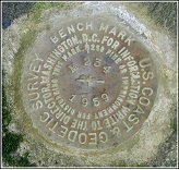
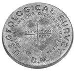
On November 8, voters in Texas will go to the polls to decide a variety of issues. Among the more unusual items on the ballot in the Lone Star State is the resolution of a property dispute. Proposition 8 would allow the Texas General Land Office to give up any state claim on an alledged land vacancy in east Texas. Developer W.L. Dixon and former land surveyor Barton McDonald claimed that the 4,662 acre King Survey was filed in error back in 1838 and that all of the land still belongs to the state. If the vacancy had been accepted, it would have created clouds on titles to more than 1,000 property owners. GLO Commissioner Jerry Patterson ruled that there was no vacancy in the King Survey. If approved by voters, the constitutional amendment would presumably put an end to any court appeals to the commissioner's ruling.

Unlike most states, Texas' public lands were never a part of the U.S. Public Land System. Instead of being divided up into Townships and Sections, the public lands of the state were distributed in a random system where every grantee could locate his land grant wherever he wanted and in whatever configuration he preferred. The result is a hodge podge of land grants that follow no system or plan. This system combined with the less precise survey instruments of the mid 1800's has left thousands of strips of land called, "vacancies," between these original land grants. The GLO estimates that approximately 1,000,000 acres of land lies in these vacancies and in the beds of navigable rivers. Little attention was paid to these vacancies until the discovery of oil. The current dispute hinges on mineral interests as well. If the vacancy had been approved, the applicants, Mr. Dixon and Mr. McDonald would be entitled to a share of the mineral rights.

Complete article from Longview News-Journal.

Oct 29, 2005

NOAA Lowers Southern Louisiana Elevations

The National Oceanic and Atmospheric Administration (NOAA) published new, lower elevations for three south Louisiana parishes recently. These newly elevations are part of a new network of vertical controls to serve as benchmarks. The agency emphasized that these new elevations should be used in rebuilding along the Gulf Coast. "Using these new benchmarks, planners will be better able to determine road and bridge heights relative to water and ground levels from these data,” stated Charlie Challstrom, acting assistant administrator of NOAA's National Ocean Service.

The new elevations are part of an ongoing effort in Louisiana to improve the accuracy of survey benchmarks and make sure that they remain accurate over time. I've posted previously on NOAA's study of subsidence along the coast. Basically, if the ground is sinking, the benchmarks are sinking with it, and such lowering can go unnoticed. To keep elevations accurate, Congress has funded height modernization programs for four Gulf Coast states. As part of this height modernization effort the National Geodetic Survey is analyzing the historical leveling data as well as new leveling and GPS surveys. They are feeding the data into updated scientific models to provide more accurate elevations on benchmarks in southern Louisiana.

Oct 28, 2005

FEMA's Flood Map Modernization Under Fire

Efforts by the Federal Emergency Management Agency (FEMA) to modernize its flood maps have come under fire recently. The San Francisco Chronicle reports that on Tuesday, the Home Security Department's inspector general issued a report on FEMA's flood map modernization program. While the report said that FEMA is making progress in modernizing its maps, a number of significant problems remain. Among the report's findings:
  • A lack of guidance on new mapping standards threatens to throw the effort off schedule.
  • FEMA has not developed policies and agreements that would allow it to cooperate with other federal mapping agencies.
The report recommended that FEMA review its program to identify high-risk areas, develop guidelines for producing accurate flood maps and improve contractor oversight. FEMA called the findings useful and said the recommendations are "generally consistent with our current plans."

FEMA's Flood Insurance Rate Maps are used to identify flood prone areas and in setting insurance rates for flood insurance policies. In the past, engineers, surveyors and city planners were pratically the only people familiar with the flood maps. The flooding following Hurricane Katrina has placed a new importance on updating and improving the maps, many of which are seriously outdated. The agency has undertaken a program to eliminate the old paper maps and implement a new, modern, web-based mapping program. The modernization is scheduled for completion in 2010.

Losing Your Land - Part III

In a previous post, I've discussed how a property owner can actually lose title to their land through adverse possession. A recent article in The Journal News highlights the misunderstanding regarding the issue.

Some of Jeffrey Gewert's backyard is fenced off by his neighbors, Patricia and Ronald Lee. In this fenced off area is a large willow tree, which he'd like to cut down. The Lees claim the land through the legal doctrine known as, "adverse possession." While specific requirements vary, the most common one is that the claimant possess the land in an open and hostile manner for a specific statuatory period. The News quotes Mr. Gewert as saying,"I think it's a crazy law. I think if more people were exposed to it, someone would change the legislation."

While Mr. Gewert's specific case is headed to the state Supreme Court, he is under a misconception. Adverse possession, which has its roots in English common law, allows a person to claim ownership of another's property if they meet certain requirements. However, it was never intended to allow someone to steal another's land. The principle came about in an agrarian society. People made their living from the land. The idea that someone would take so little care of his most valuable asset, his land, was foreign to them.

The principle also developed in a time when people placed less reliance on deeds. In the colonies, many towns had a special day set aside when the men of the town would walk the boundaries of the citizen's lands, re-establishing in everyone's minds, just exactly where they were located. The legal term, "metes and bounds" has its origins in this process where land was frequently described as being, "bounded" by the lands of another.

In actuality, the principle was to protect the neighbor that inadvertently encroached upon someone else's land. Let's say a landowner constructed a barn or fence upon his neighbor's property. This neighbor showed so little interest in the land that he did not notice for an extended period. It was felt that it was unfair to require the encroaching landowner to suffer the loss of his fence or barn, or possibly the loss in income from crops he'd been cultivating on the land. So the principle of adverse possession was established. While people don't go out and walk the "bounds" of farms today, the concept still applies to landowners. Anyone that owns property should make sure that they know the bounds of their property and protect them from encroachment because centuries of legal tradition presume that they do.


Oct 27, 2005

USGS Outsourcing Plans On Hold

Besides taking another look at consolidating mapping operations into the National Geospatial Technical Operations Center in Denver, The United States Geological Survey has put on hold plans to outsource most of its major mapping operations as well. Instead, the agency is looking into a plan that would stretch the proposed downsizing out over a five to ten year period, allowing both its Denver and Rolla offices to remain open during that time.

Complete story from the Rolla Daily News.

Oct 24, 2005

Ohio Plans To Map Shipwrecks

The Ohio Department of Natural Resources is making plans to map some of the shipwrecks beneath Lake Erie. The department's Division of Geological Survey is seeking a three-year, $220,000 grant from the National Oceanic and Atmospheric Administration to start the mapping project. If the grant is approved, the state will add $63,000 to the project's budget. According to the Detroit Free Press, the project would mark four of the of the lake's zones as "underwater trailways." Previously, when officials tried to mark several Lake Erie shipwreck sites as preserves, the plan became embroiled in controversy with landowners over property rights.

According to the Great Lakes Historical Society, Lake Erie has at least 1,500 shipwrecks, many dating back to the late 1800s and early 1900s. Roughly 600 of those wrecks are in Ohio. The maps to the shipwrecks would be published in guides that would include photographs, historical details and coordinates that would allow divers to locate the sites with global positioning equipment. The plan is based on a similar program in Wisconsin that maps shipwrecks in lakes Michigan and Superior.

Oct 22, 2005

Surveying Ancient Cities Without Digging

The Center for Ancient Middle Eastern Landscapes (CAMEL) is taking a radically new approach to archaeological research, attempting to survey ancient sites while disturbing them as little as possible. Traditionally, archaeologists have relied on the destructive method of removing buried artifacts and examining them. CAMEL's method however, organizes maps, aerial photography, satellite images and other data into one place, allowing archaeologists to see how ancient trade routes developed and to prepare simulations of how people may have interacted, given the limitations of their space, the availability of resources and the organization of their cities. The system begins with aerial images from the 1950s and 1960s. The older photographs are valuable because they depict mounds and other features. While these mounds may be rich in ancient material, modern day farming and irrigation have leveled many of them making it impossible to locate them. That's why the old aerial images are combined with new satellite images from NASA, Digital Globe and others, so researchers can better determine where these potentially valuable sites are located.


This new nondestructive method is being used at Kerkenes Dag in central Turkey (pictured above). The University of Chicago Chronicle describes the work of Scott Branting there:

"By employing a range of observational and remote sensing techniques across the entire area of the city, we have been able to fill in the blank spaces on an earlier map made by the Oriental Institute,"” Branting said. The work, which includes the techniques used at CAMEL to map accurately a site with photographs, provided archaeologists a chance to work with a high degree of precision once digging began. Currently, another season of excavation is underway.

"Since so much can be seen on the surface at Kerkenes Dag, this has proved to be a very effective technique,"” Branting said.

Global Positioning System technology has allowed scholars to record the minute topography of the entire ground surface within the site. "“Never before in archaeology has this technique been undertaken on such a grand scale. The terrain model is the basis for ongoing work to produce a virtual reconstruction of the entire city, neighborhood by neighborhood, building by building,"” he said.

By using the techniques, the team was able to locate the gateway of the palace complex and find the first fragmentary inscriptions and reliefs to be recovered at the site. They have been able to date the site to the mid- to late-seventh century through the mid-sixth century B.C.


Oct 21, 2005

USGS To Stay For Now

The U.S. Interior Department is putting its plans to consolidate consolidate its operations into the National Geospatial Technical Operations Center in Denver on hold while they take another look at the issue.

The Rocky Mountain News:
Earlier this month, Missouri Rep. Jo Ann Emerson and Sens. Kit Bond and Jim Talent, all Republicans, asked the agency's inspector general to launch a formal probe of a decision they say was made without proper justification.

In a statement Friday, the agency said Assistant Interior Secretary Mark Limbaugh "has directed a review of the decision process in light of questions raised about that process."

The federal agency announced plans in September to consolidate operations from Rolla; Menlo Park, Calif.; and Reston, Va., into the National Geospatial Technical Operations Center in Denver. The move would force 187 Rolla employees out of their jobs within a year.

Missouri lawmakers complained the decision ignored the recommendation of an internal committee that found Rolla was the best choice for consolidation based on wages and operating costs.

"I am glad the Department of Interior is willing to review this arbitrary decision, because I think a mistake has been made which needs to be corrected," Emerson said in a statement.

One of the city's largest employers, the USGS office has been in Rolla since 1921.


EnviroMapper For Hurricanes Katrina and Rita

Residents of the New Orleans area concerned about environmental quality can access test data collected by the Environmental Protection Agency (EPA) online. The EPA has launched, EnviroMapper for Hurricanes Katrina and Rita. The site combines interactive maps and aerial photography to geographically display test results from air, surface water, flood water and sediment sampling in the areas impacted by the hurricanes. Test Data from both flood waters and sediment are posted on the site. The EPA says that the database presents the most complete data set available.

The interactive map allows users to search a variety of fields. The EPA's test locations appear on a map of the area as green stars. A number of features can be toggled on or off from a menu bar on the right side. Users can chose from an atlas view, an aerial photo, or a topographic map, as a base map. Clicking on the star yields the testing date, the specific location and type of test, a list of pollutants found in the sample, the measured value of the pollutants, as well as a brief description of the pollutants.


Oct 20, 2005

Map Of Alaskan Refuge Is Missing

The only copy of the map of the Arctic National Wildlife Refuge is missing. The New York Times reports that when Congressional aides went to retrieve the map from storage in Arlington, Virginia, it was gone. The wall-size map, drawn at a scale of 1:250,000 feet, depicted the tundra in the environmentally sensitive area, which has been the source of a bitter debate over plans to allow oil exploration there. The map had last been seen in late 2002. There were no copies and no digitized version.


The loss of the map may have very real-world consequences. The U.S. Geological Survey prepared a new map. However, opponents to oil exploration have said that the new map includes tens of thousands of acres of coastal plains that were not included on the original map. Inclusion of those areas on the map would make it easier to drill for oil there.

The Times quotes Doug Vandegraft, the cartographer for the Fish and Wildlife Service who is the last known person to see the map as saying, "People have asked me several times, 'Do you think someone took this intentionally?' I hope to God not. So few people knew about it. I'm able to sleep at night because I don't think it was maliciously taken. I do think it was thrown out." Mr. Vandegraft said he had folded the map in half, cushioned within its foam-board backing, and put it behind the filing cabinet in a locked room for safekeeping. When the aides sought to retrieve the old map, there was only a new, folded piece of foam board, similar to the old one, but with one big difference. There was no map attached. No one has admitted knowing what happened to the map.

Complete article from The New York Times. (Registration required)


Oct 19, 2005

Still More Complaints About Google Maps

You can't please everyone. First it was Taiwan, complaining that Google Maps referred to the island as, "Taiwan, a province of the People's Republic of China." The Taiwanese consider themselves a sovereign country, mainland China considers the island a rebellious province. The offending words disappeared after the complaints. Google says the wording was removed as part of a regular update, others suspect the change was made under pressure from Taiwan. Now the Chinese are upset.

CRI Online reports:
Peng Keyu, consul general of the Chinese consulate in San Francisco, voiced objection to the Google decision and urged it to follow the US government's allegiance to the one-China principle, according to the SingTao Daily.
From Cartography.

Oct 18, 2005

Old & New Combine To Map "Eternal City"

In 1748, architect and surveyor Giambattista Nolli completed a map of his hometown of Rome titled, "The Pianta Grande di Roma" (Great Plan of Rome). The map, which was made from 12 minutely detailed copper plates, measured six by seven feet. It was so accurate that it continued to be used as the basis for government maps of the city until the 1970s.

Nolli's map featured several cartographic firsts including:
  • The first map to use the ichnographic, or plan, style rather than the more popular "bird's eye view."
  • The first map to use dark shades to mark buildings and private spaces and light shades for streets and public spaces.
  • The first map oriented so that North, rather than East, was at the top of the page.
Over 250 years later, Nolli's map has been reborn thanks to a team at the University of Oregon that has put his map online. The map in its online form continues Nolli's tradition of innovation as it combines history, cartography, urban design, and architecture into a single presentation.

The University of Oregon's site will be of interest to both ancient map enthusiasts as well as anyone in the survyeing, mapping and GIS professions. One of the innovations of the site is that it combines Nolli's ancient map with a layer containing
a 1-meter resolution satellite image of the city from Space Imaging, Inc. By combining this new and old technology, the site allows the viewer to compare "before" and "after" views of the city, revealing how little the "Eternal City" has changed in two centuries. Comparing modern satellite image with Nolli's hand drawn map, one can only marvel at the extraordinary accuracy of his map, leaving the viewer to wonder if cartographers 250 years from now will have similar admiration for their current work.


The Interactive Nolli Map Website.
Complete article from the Christian Science Monitor.


GPS Tracking Brings Civil Rights Concerns

A new law has given California probation officials broad authority to use global positioning system (GPS) devices on probationers. Under the system, officials can attach a GPS device to either the ankle or wrist of a probationer. The unit allows probation officials to view offenders' locations on a map, 24 hours a day, in real time, from their desktop computer screen.

Not suprisingly, the system disturbs civil libertarians, who cite privacy concerns. Newsday quotes Ignacio Hernandez, with the California Attorneys for Criminal Justice, as saying, "There are no checks or balances for this, and no way to know what it is going to be used for." He also told Newsday that the law is too broad and gives probation officials powers well beyond what they need to do their jobs.

On the other hand, law enforcement and other government officials are encouraged by the new GPS tracking system. "In an ideal world, we would have one on every offender," Jeff Fagot, regional parole administrator for the California Department of Corrections, told Newsday. Other supporters envision even broader uses of the GPS devices. Governor Arnold Schwarzenegger has proposed that registered felony sex offenders be forced to wear the bracelets for the rest of their lives.

More Complaints Over Google Maps

More security complaints over Google Earth, this time from India.

From Forbes:
President Abdul Kalam has warned that Google Inc's satellite image service could help terrorists find targets and may pose a serious threat to national security.

Indian media reports said the Google satellite service (http://earth.google.com), launched in June, allows people to view high-resolution images of installations such as the Bombay headquarters of India's western naval command.

'Users can zoom close enough to take a reasonably good look at the deck of India's lone aircraft carrier. Browse around and you can stroll past piers where warships of all kinds and submarines are docked,' the Times of India said.

The site contains clear aerial photos of India's parliament and the president's palace in New Delhi, prompting Kalam to warn that he is worried 'developing countries, already in danger of terrorist attacks, have been chosen' for exposure.

A spokesman for Kalam said the president has asked officers to check 'whether the images pose a threat to national security.'

Outsourcing USGS

A new report on the U.S. Geological Survey outsourcing its map making functions. FCW.com reports the agency is considering outsourcing or eliminating most of its major mapping operations, saying that commercial remote-sensing products and other advanced technologies have replaced field surveyors. The move would cost about 400 employees their jobs.

From The Map Room & Cartography.

Oct 16, 2005

Mapping Katrina's Storm Surge - Part II

Though not complete, initial reports from the surveyors that are mapping Hurricane Katrina's storm surge seem to indicate that Katrina's storm surge was as bad as anything ever seen along the Mississippi gulf coast. "The flood elevations are extraordinarily high," FEMA's Todd Davison told the Sun-Herald. "Anybody who has studied storm surge, these are well in excess of 100-year flood numbers."

Data Collection

The mapping of Katrina's storm surge in Mississippi, which has been described as, "forensic meteorology" is a team effort, with surveyors from the U.S. Geological Survey, the Army Corps or Engineers, and URS Corporation, an international engineering firm, performing the measurements. The survey crews most commonly look for water marks on the inside of buildings. Waves don't blur the true height of the surge inside buildings. Once they've located a water mark, they determine the elevation of the mark, not always an easy task in an area where many of the benchmarks have been washed away. While the surveyors continue to refine their data, early indications are the Katrina's storm surge reached as high as 28 feet.

Map Preparation

FEMA, which is spearheading the project, plans to use the data to update it's 100-year flood plain maps. However, the new 100-year flood plain elevations shown on the updated maps may not be as high as Katrina's storm surge. Experts think such an event is beyond the pale of a 100-year flood event. "It's fair to say the 100-year is going to go up," Davison told the Sun-Herald, "but they won't go to the Katrina levels." FEMA has already released suggestions to local officials on how to rebuild, based on predictions of what the ultimate revised 100-year flood elevation will be. FEMA plans to release the first round of tabular data this week, with a high-resolution map available online by mid-November.

Oct 13, 2005

Wrong Numbers In GPS Unit Leads Surveyors Down Wrong Road

Three land surveyors face fines of up to $500 after being issued federal citations for trespassing onto the grounds of the Casa Grande Ruins National Monument. According to the Casa Grande Valley Newspaper, the three men, blame incorrect coordinates they entered into their handheld GPS navigation device for the incident. Following their GPS unit's directions, they went to the wrong side of Arizona Boulevard, where they turned onto West Ruins Drive, and drove past a sign warning unauthorized vehicles not to continue. They opened a chained gate with a sign marked, "Closed Area Do Not Enter" and drove about half a mile onto federal property. After driving a surveying stake into the ground and marking it with orange paint, they became suspicious that they were in the wrong place and decided to leave to obtain a better map of the area. To their credit, upon realizing their error, the surveyors returned to the monument grounds to remove the stake and smooth their tire tracks. It was then that they were confronted by National Park Service Ranger and local police.

Oct 10, 2005

Mapping Katrina's Storm Surge

The Map Room links to an excellent story from Wired News on surveyor's that are attempting to map Hurricane Katrina's storm surge. Emergency planners want to use the data to help prepare for future hurricanes. It's interesting that even with satellites, LIDAR, and all the other high-tech equipment availible, there is still a need for on-the-ground measurements.

Oct 9, 2005

New Chinese Survey Lowers Everest's Height

China's surveying and mapping department reports that a new measurment of the world's tallest mountain shows it's elevation is actually 3.7 meters shorter than the measurement taken in 1971. According to a report by the Asian Tribune:
"The summit rock of Mount Qomolangmais (Mt Everest) is 8,844.43 meters above sea level," the China’s official news agency Xinhua reports.

"The newly measured height is 3.7 meters shorter than the measurement of 8,848.13 meters, a figure obtained during the previous measurement taken in 1971," says the report quoting Chen Bangzhu, director general of the China's State Bureau of Surveying and Mapping (SBSM).

SBSM has claimed that the measurement was undertaken using improved technology and it is more accurate. The margin of error is 0.21 meters and the ice and snow layer at the mountain summit is 3.5 meters in thickness.

The latest finding is based on measurements done by Chinese mountaineers who reached Everest summit in the afternoon of May 22, 2005.

"The measurements were conducted at the six control points by means of theodolites and laser rangers for 48 hours. Surveyors at the mountain summit measured the thickness of the ice and snow layers under the survey marker with radar altimeter," the report says.

Surveys in the past have come up with conflicting conclusions about the height of Mt Everest. The first measurement, conducted in 1856, put the height at 8,839 meters. In 1950, an Indian survey put the height at 8,848 meters. An American expedition that put a GPS unit atop the peak in 1998 concluded the height to be 8,850 meters.
China's surveyors attributed the differences to more modern methods. It is widely believed that Mt Everest is growing taller by 3 to 5 millimeters each year.


Oct 8, 2005

USGS To Subcontract New Topographic Maps

The following is from the Government Affairs Update from the American Congress on Surveying and Mapping:

The USGS Coalition met recently with Acting USGS Director Patrick Leahy to get an update on USGS issues. Leahy talked about the role of the USGS in the recovery of New Orleans from Hurricane Katrina. He called the events of Katrina a "failure of science" because it could have been prevented if science was properly used. He said that in the days after the flood in New Orleans, the USGS provided topographic maps with detailed imagery that changed daily to reflect the changing conditions of the city. He also said that LIDAR was used to determine the condition of the failing levees.

As a result of what happened in New Orleans, Leahy said, other flood prone cities and localities are pushing the USGS for topographic maps. To respond to the increased need for topographic maps, the USGS will start contracting with state and local governments, as well as the private sector for the development of the new maps.

Montana Road Dispute Leads To The Courthouse

A 1917 U.S. Surveyor General's map may determine whether the public will have uninterrupted access to roughly 1/3 of the Upper Missouri River Breaks National Monument. According the Havre Daily News, Bill and Ronnie Robinson contend that Bullwhacker Road, which crosses their ranch about 50 miles south of Chinook, Montana, is a private road. They have been requiring that the public seek their permission before using it to travel to the recreation area. Not so, says the Montana Wildlife Federation and the Public Land and Water Access Association Inc., which contend the road is public. At a meeting last Thursday, Bernard Lea, of the Public Land and Water Access Association, produced a copy of the 1917 U.S. Surveyor General's map, which he says shows the road following almost exactly the same route it follows today. Lea contends that under a 1866 federal statute, any road that existed before the adjacent land was granted to private citizens is to remain a public road. The Robinsons, who began requiring permission to use the road after gates were left open and people started trespassing on their property, contend the road shown on the 1917 map is not the same road in dispute today. The groups of hunters and outdoor enthusiasts say they will probably take the mater to court.

Until a judge decides the matter or some compromise can be reached, governments are not sure what to do. Blaine County does not consider the road a county road and has never maintained it. During a recent inventory, the Montana Department of Transportation noted the "No Trespassing" signs placed by the Robinson's and has removed the road from their maps.

People living in heavily populated urban areas may wonder how the public or private status of a road can be contested. However, in the sparsely populated west, many roads are infrequently traveled and poorly maintained. That and their often murky legal origins make these types of disputes fairly common.

Oct 6, 2005

Modernizing Coastal Flood Maps

U.S. Senator Jack Reed (D-R.I) plans to introduce legislation he says will improve the government's coastal flood hazard mapping system. "Currently, federal coastal maps do not reflect the real flood hazard risks," Reed told the Westerly Sun. "Over 70 percent of the Federal Emergency Management Agency maps are over ten years old." Senator Reed wants FEMA to include information on coastal flooding reflected in the Army Corps of Engineers flood maps. His bill would authorize The Corps to update their coastal flood maps along the Atlantic coast and share that information with FEMA. The legislation also directs FEMA to include The Corps' coastal flooding information on their flood insurance maps as part of the agency's map modernization program.


Hurricanes Rita and Katrina have focused attention on FEMA's effort to modernize its outdated flood maps, many of which do not take into account coastal development, erosion and other factors that have altered floodplains over the years. The Senate Banking Committee plans to look into the effectiveness of the national flood insurance program. According to the Center on Federal Financial Institutions, participation in the insurance program by property owners in flood-prone areas appears to be below 40%.


Oct 4, 2005

Taiwan Complains About Google Maps

Add Taiwan to the list of countries complaining about Google Earth. Previously several countries have expressed concerns that Google's online maps may make life easier for terrorists and other enemies. The government of Taiwan has a different complaint. According to All Headline News, Taipei has asked Google to stop calling the self-governing island a "province of China" on its Google Maps service.

China regards Taiwan as a breakaway province. It has also warned to attack the island if it insists on formal statehood. The two countries separated in a civil war, which ended in 1949. Taiwan insists it is a sovereign, independent state.

Foreign ministry spokesman Michel Lu says, "It is incorrect to call Taiwan a province of China because we are not." He adds, "We have contacted Google to express our position and asked them to correct the description."

The foreign ministry has yet to receive a reply from Google.

For a summary of countries that have expressed concerns about the online mapping service, see The Map Room.


Oct 1, 2005

Update On Flood Map Updates

With images of the damage caused by Hurricane Katrina fresh in there minds, communities are paying extra attention to the 100-Year Flood Plain. While once strictly the purview of civil engineers and city planners, government officials and ordinary citizens are asking tough questions about new development and looking for answers.


The Loveland Colorado City Council was contemplating numerous ideas for redeveloping the old fairgrounds downtown. The city's flood map, which was last updated in 1982 had not shown the land in the flood plain. But according to an article in the Loveland Reporter-Herald, a new study of the property discovered that due to surrounding development, much of the land was now in the flood plain. The city had originally envisioned development such as a river walk or a collection of community buildings for the site. Those plans were scrapped due the huge cost of reclaiming land from the flood plain. The city is now pursuing ideas for recreational development that can be constructed within the flood plain.

In Washington Township, Pennsylvania, local residents were concerned about the accuracy of their community's flood maps and a new development's impact on it. The township's flood map was last updated back in 1991. So they launched their on investigation, drawing on local's recollections of high water marks and historic photographs of flooding from the local paper. According to the Waynesboro Record Herald, when asked about their findings, FEMA spokesman Philip Clark said, "They could be right. We don't always have all the information available." The township supervisors approved the development but have asked FEMA to review the town's flood map.

While many people struggle with outdated flood maps, residents of New Hampshire continue to complain that newer, digital maps are costing them money. According the Exeter News-Letter, some residents of Rockingham and Strafford Counties are upset that the updated flood maps have necessitated the purchase of flood insurance, now that the flood zones are more identifiable.

I posted previously on FEMA's efforts at modernizing their flood maps. Perhaps this interest in mapping of flood risks will result in more funding from congress and directions to speed up the effort. Or perhaps, FEMA will be too distracted with efforts to address concerns about their disaster preparedness and put their mapping modernization on the back burner.